Chilliwack night lights from space
Night Light of Chilliwack (British Columbia) from space (Canada) Src. Average luminocity for 10x10km area is 33.4076% and for 50x50km: 4.3277%.
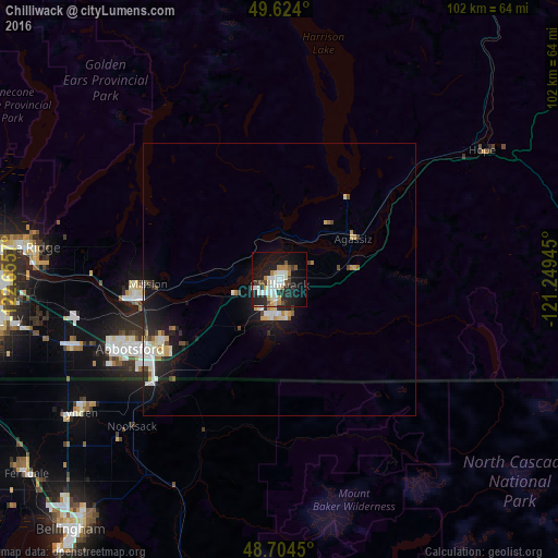
Analysis of Chilliwack night lights 2016
Square area 10x10 km:
 6.72%
6.72%90-99
8.4%80-89
3.22%70-79
1.26%60-69
4.34%50-59
2.1%40-49
3.22%30-39
2.94%20-29
12.89%10-19
29.13%0-9
25.77%Square area 50x50 km:
0.77%90-99
0.91%80-89
0.51%70-79
0.34%60-69
0.45%50-59
0.24%40-49
0.38%30-39
0.46%20-29
1.38%10-19
3.79%0-9
90.78%Clear (daylight) street map image can be seen on geolist.org.
Map coordinates:
49° 37' 26.4" North, 122° 39' 20.5" West
49° 9' 59" North, 121° 57' 9.3" West
48° 42' 16.2" North, 121° 14' 58" West
Some cities around Chilliwack sort by population:
• Abbotsford
24.9 km =15.5 mi,  241°
241°
• Maple Ridge
47.6 km =29.6 mi,  277°
277°
• Mission
25.7 km =16 mi,  261°
261°
• Walnut Grove
50 km =31.1 mi,  269°
269°
• Langley
51.9 km =32.2 mi, 261°
• Pitt Meadows
53.9 km =33.5 mi, 276°
• Lynden, US
43.8 km =27.2 mi, 236°
• Aldergrove
39.6 km =24.6 mi,  252°
252°
5921356 (p: 77,000)
Sources (retrieved 2019-11-25):
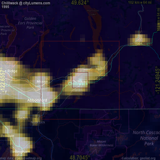
» NASA, Earths city lights 1995
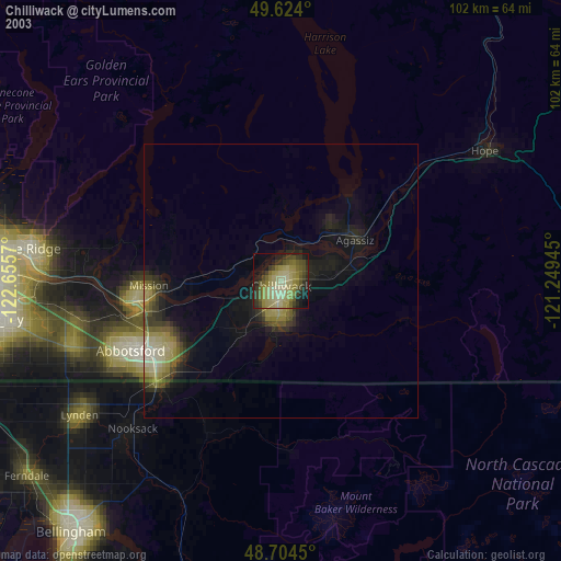
» NASA city lights 2003
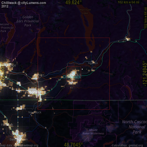
» Earth at Night: Flat Maps 2012, 2016