Sinop night lights from space
Night Light of Sinop (Mato Grosso) from space (Brazil) Src. Average luminocity for 10x10km area is 70.9277% and for 50x50km: 5.7056%.
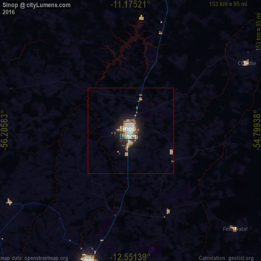
Analysis of Sinop night lights 2016
Square area 10x10 km:
 16.53%
90-99
21.49%80-89
10.12%70-79
10.12%60-69
7.02%50-59
7.85%40-49
9.09%30-39
5.99%20-29
9.09%10-19
2.69%0-9
0%Square area 50x50 km:
0.77%90-99
0.99%80-89
0.67%70-79
1.09%60-69
0.54%50-59
0.53%40-49
0.85%30-39
0.88%20-29
1.3%10-19
4%0-9
88.38%Clear (daylight) street map image can be seen on geolist.org.
Map coordinates:
11° 10' 30.8" South, 56° 12' 20.3" West
11° 51' 51" South, 55° 30' 9" West
12° 33' 5" South, 54° 47' 57.8" West
Some cities around Sinop sort by population:
• Barra do Bugres
400.2 km =248.7 mi,  206°
206°
• Nova Olímpia
379 km =235.5 mi, 210°
• Diamantino
300.8 km =186.9 mi,  199°
199°
• Chapada dos Guimarães
400.8 km =249 mi,  183°
183°
• Nobres
329.9 km =205 mi, 195°
• Rosário Oeste
345.3 km =214.6 mi, 196°
• Nortelândia
320.6 km =199.2 mi, 206°
• Arenápolis
322.2 km =200.2 mi, 206°
6318696 (p: 116,013)
Sources (retrieved 2019-11-25):
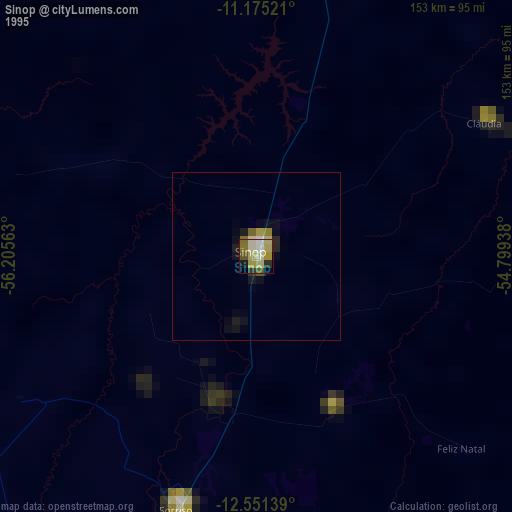
» NASA, Earths city lights 1995
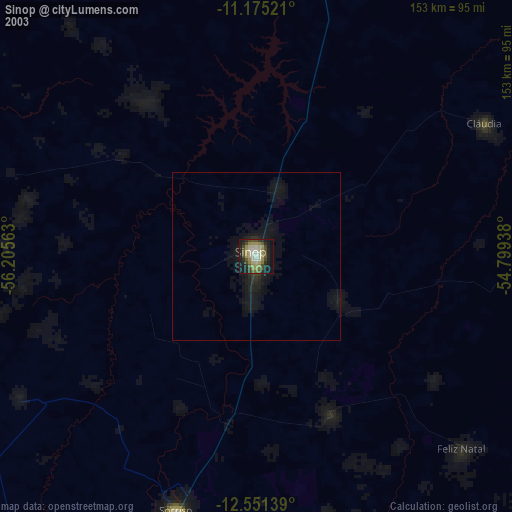
» NASA city lights 2003
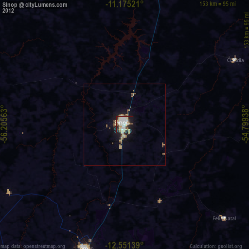
» Earth at Night: Flat Maps 2012, 2016