Santa Cruz do Sul night lights from space
Night Light of Santa Cruz do Sul (Rio Grande do Sul) from space (Brazil) Src. Average luminocity for 10x10km area is 65.6607% and for 50x50km: 6.1919%.
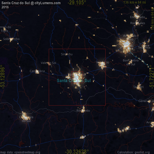
Analysis of Santa Cruz do Sul night lights 2016
Square area 10x10 km:
 16.67%
90-99
15.48%80-89
11.11%70-79
11.31%60-69
6.15%50-59
5.36%40-49
4.76%30-39
5.36%20-29
19.84%10-19
3.97%0-9
0%Square area 50x50 km:
0.81%90-99
0.78%80-89
0.99%70-79
0.93%60-69
0.54%50-59
0.75%40-49
0.8%30-39
1%20-29
2%10-19
4.27%0-9
87.12%Clear (daylight) street map image can be seen on geolist.org.
Map coordinates:
29° 6' 18" South, 53° 7' 44.3" West
29° 43' 3" South, 52° 25' 33" West
30° 19' 34.6" South, 51° 43' 21.8" West
Some cities around Santa Cruz do Sul sort by population:
• Cachoeira do Sul
57.6 km =35.8 mi,  231°
231°
• Lajeado
52.8 km =32.8 mi,  58°
58°
• Venâncio Aires
25.8 km =16 mi, 61°
• Candelária
35.5 km =22.1 mi,  278°
278°
• Taquari
55 km =34.2 mi,  99°
99°
• Rio Pardo
30.6 km =19 mi,  171°
171°
• Butiá
63.2 km =39.3 mi,  135°
135°
• Arroio do Meio
58.3 km =36.2 mi,  52°
52°
3450269 (p: 106,113)
Sources (retrieved 2019-11-25):
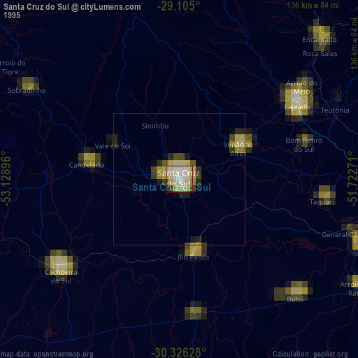
» NASA, Earths city lights 1995
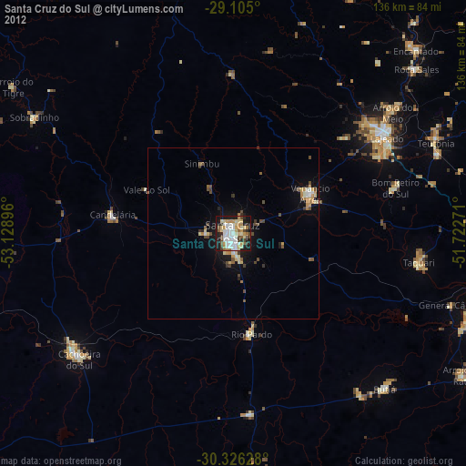
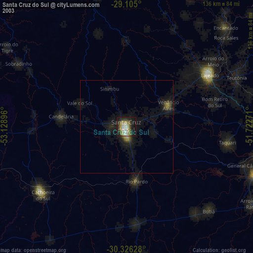
» NASA city lights 2003
» Earth at Night: Flat Maps 2012, 2016