Nova Friburgo night lights from space
Night Light of Nova Friburgo (Rio de Janeiro) from space (Brazil) Src. Average luminocity for 10x10km area is 46.108% and for 50x50km: 6.1888%.
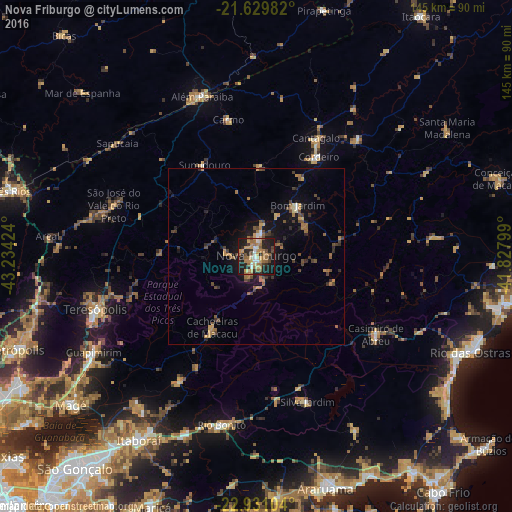
Analysis of Nova Friburgo night lights 2016
Square area 10x10 km:
 3.98%
3.98%90-99
5.11%80-89
5.11%70-79
10.98%60-69
14.77%50-59
6.25%40-49
4.36%30-39
4.17%20-29
20.27%10-19
24.62%0-9
0.38%Square area 50x50 km:
0.28%90-99
0.3%80-89
0.47%70-79
1.18%60-69
1.6%50-59
0.92%40-49
1.27%30-39
1.09%20-29
1.54%10-19
4.42%0-9
86.94%Clear (daylight) street map image can be seen on geolist.org.
Map coordinates:
21° 37' 47.4" South, 43° 14' 3.3" West
22° 16' 55" South, 42° 31' 52" West
22° 55' 51.7" South, 41° 49' 40.8" West
Some cities around Nova Friburgo sort by population:
• Cachoeiras de Macacu
23.7 km =14.7 mi,  211°
211°
• Além Paraíba
47.3 km =29.4 mi,  337°
337°
• São Pedro
47.4 km =29.5 mi,  250°
250°
• Casimiro de Abreu
40.2 km =25 mi,  123°
123°
• Silva Jardim
43.4 km =27 mi,  160°
160°
• Cordeiro
33.2 km =20.6 mi,  31°
31°
• Cantagalo
37.4 km =23.2 mi, 26°
• Carmo
39.5 km =24.5 mi,  348°
348°
3456166 (p: 153,361)
Sources (retrieved 2019-11-25):
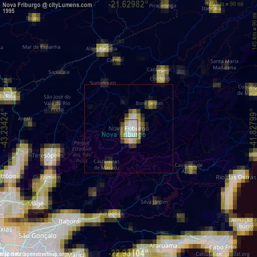
» NASA, Earths city lights 1995
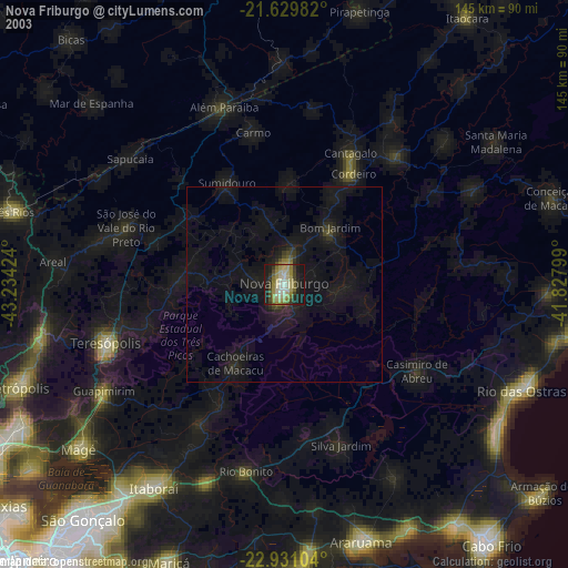
» NASA city lights 2003
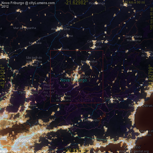
» Earth at Night: Flat Maps 2012, 2016