Janaúba night lights from space
Night Light of Janaúba (Minas Gerais) from space (Brazil) Src. Average luminocity for 10x10km area is 38.5758% and for 50x50km: 2.1175%.
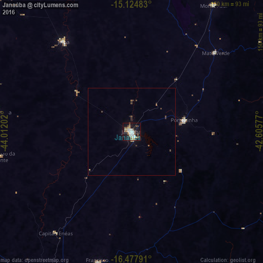

Analysis of Janaúba night lights 2016
Square area 10x10 km:
 8.01%
8.01%90-99
8.44%80-89
5.19%70-79
2.6%60-69
1.3%50-59
8.87%40-49
5.19%30-39
0.65%20-29
3.9%10-19
44.59%0-9
11.26%Square area 50x50 km:
0.3%90-99
0.32%80-89
0.29%70-79
0.1%60-69
0.11%50-59
0.41%40-49
0.4%30-39
0.19%20-29
0.25%10-19
2.14%0-9
95.49%Clear (daylight) street map image can be seen on geolist.org.
Map coordinates:
15° 7' 29.4" South, 44° 0' 43.3" West
15° 48' 9" South, 43° 18' 32" West
16° 28' 40.5" South, 42° 36' 20.8" West
Some cities around Janaúba sort by population:
• Barreiro do Jaíba
36.8 km =22.9 mi,  304°
304°
• Porteirinha
30.7 km =19.1 mi,  77°
77°
• Francisco Sá
77.3 km =48 mi,  194°
194°
• Monte Azul
85.7 km =53.3 mi,  32°
32°
• Rio Pardo de Minas
85.1 km =52.9 mi, 75°
• São João da Ponte
76.1 km =47.3 mi,  259°
259°
• Mato Verde
65.4 km =40.6 mi,  46°
46°
• Varzelândia
77.7 km =48.3 mi,  278°
278°
3460174 (p: 56,572)
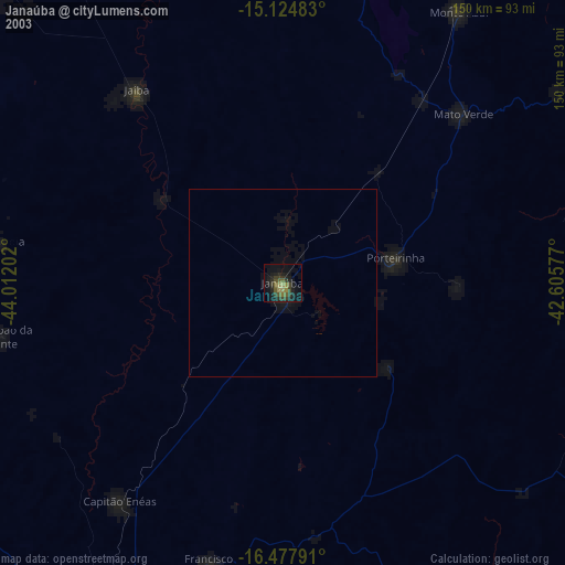
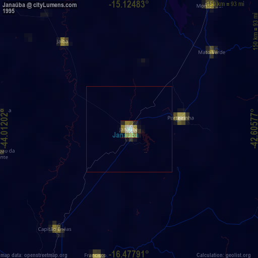
Sources (retrieved 2019-11-25):
» NASA, Earths city lights 1995
» NASA city lights 2003
» Earth at Night: Flat Maps 2012, 2016