Capitão Poço night lights from space
Night Light of Capitão Poço (Pará) from space (Brazil) Src. Average luminocity for 10x10km area is 13.6472% and for 50x50km: 1.6569%.
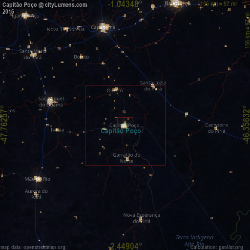
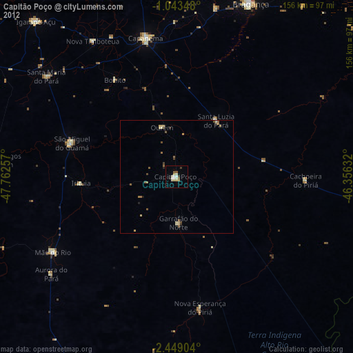
Analysis of Capitão Poço night lights 2016
Square area 10x10 km:
 0.65%
0.65%90-99
2.81%80-89
4.98%70-79
1.95%60-69
0%50-59
0%40-49
2.38%30-39
0.43%20-29
0.65%10-19
1.95%0-9
84.2%Square area 50x50 km:
0.06%90-99
0.18%80-89
0.37%70-79
0.27%60-69
0.23%50-59
0.21%40-49
0.42%30-39
0.19%20-29
0.16%10-19
0.23%0-9
97.68%Clear (daylight) street map image can be seen on geolist.org.
Map coordinates:
1° 2' 36.5" South, 47° 45' 45.3" West
1° 44' 47" South, 47° 3' 34" West
2° 26' 56.5" South, 46° 21' 22.8" West
Some cities around Capitão Poço sort by population:
• Bragança
83.7 km =52 mi,  22°
22°
• Capanema
62.7 km =39 mi,  347°
347°
• São Miguel do Guamá
49 km =30.4 mi,  285°
285°
• Igarapé Açu
92.7 km =57.6 mi,  317°
317°
• Augusto Corrêa
93.4 km =58 mi,  30°
30°
• Santa Maria do Pará
72.3 km =44.9 mi,  307°
307°
• Ourém
22.5 km =14 mi,  344°
344°
• Irituia
42.2 km =26.2 mi,  266°
266°
3403127 (p: 32,704)
Sources (retrieved 2019-11-25):
» Earth at Night: Flat Maps 2012, 2016