Cachoeiro de Itapemirim night lights from space
Night Light of Cachoeiro de Itapemirim (Espírito Santo) from space (Brazil) Src. Average luminocity for 10x10km area is 53.7202% and for 50x50km: 11.6205%.
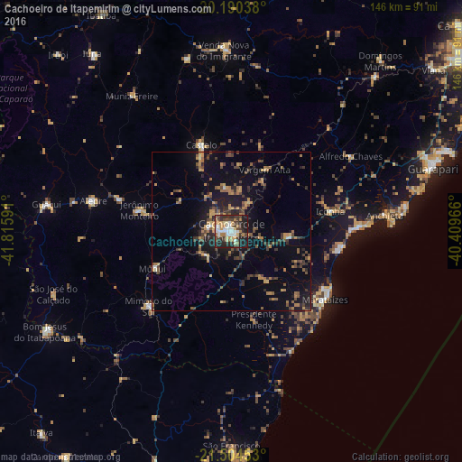
Analysis of Cachoeiro de Itapemirim night lights 2016
Square area 10x10 km:
 11.11%
90-99
9.92%80-89
5.16%70-79
8.13%60-69
8.73%50-59
2.78%40-49
9.13%30-39
15.67%20-29
15.87%10-19
13.49%0-9
0%Square area 50x50 km:
0.58%90-99
0.62%80-89
0.99%70-79
1.94%60-69
2.04%50-59
1.82%40-49
3.03%30-39
2.22%20-29
3.43%10-19
8.1%0-9
75.23%Clear (daylight) street map image can be seen on geolist.org.
Map coordinates:
20° 11' 25.4" South, 41° 48' 57.3" West
20° 50' 56" South, 41° 6' 46" West
21° 30' 16.3" South, 40° 24' 34.8" West
Some cities around Cachoeiro de Itapemirim sort by population:
• Marataizes
36.9 km =22.9 mi,  125°
125°
• Castelo
28.3 km =17.6 mi,  344°
344°
• Piúma
40.6 km =25.2 mi,  88°
88°
• Itapemirim
34.1 km =21.2 mi,  121°
121°
• Mimoso do Sul
35.6 km =22.1 mi,  227°
227°
• Jerônimo Monteiro
30.1 km =18.7 mi,  282°
282°
• Rio Novo do Sul
18.4 km =11.4 mi, 94°
• Iconha
32 km =19.9 mi,  78°
78°
3468376 (p: 187,019)
Sources (retrieved 2019-11-25):
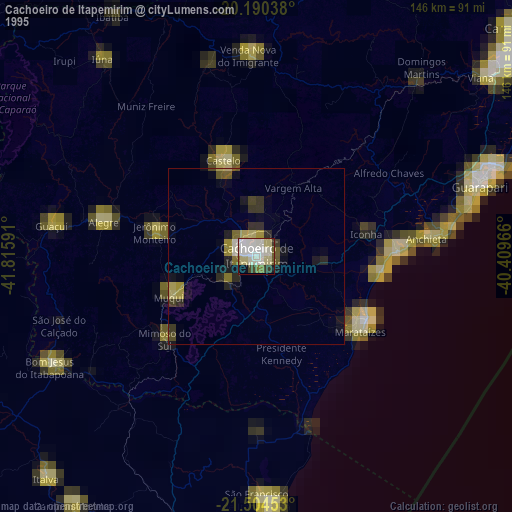
» NASA, Earths city lights 1995
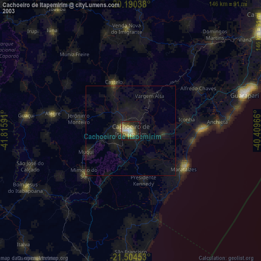
» NASA city lights 2003
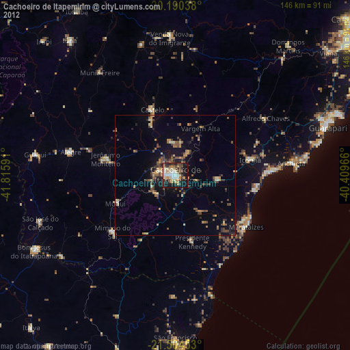
» Earth at Night: Flat Maps 2012, 2016