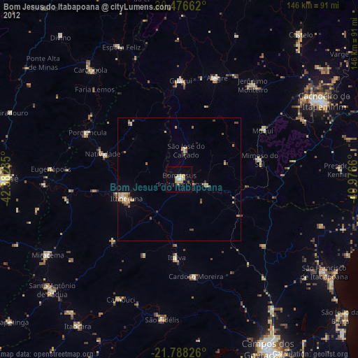
Bom Jesus do Itabapoana night lights from space
Night Light of Bom Jesus do Itabapoana (Rio de Janeiro) from space (Brazil) Src. Average luminocity for 10x10km area is 15.6409% and for 50x50km: 3.1592%.
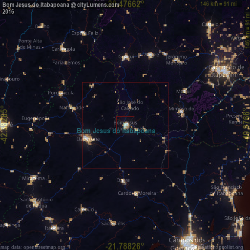
Analysis of Bom Jesus do Itabapoana night lights 2016
Square area 10x10 km:
 1.39%
1.39%90-99
3.97%80-89
0.99%70-79
0.79%60-69
5.56%50-59
0.2%40-49
1.39%30-39
0.79%20-29
1.59%10-19
1.98%0-9
81.35%Square area 50x50 km:
0.17%90-99
0.24%80-89
0.41%70-79
0.89%60-69
0.6%50-59
0.27%40-49
0.7%30-39
0.38%20-29
0.34%10-19
1.08%0-9
94.92%Clear (daylight) street map image can be seen on geolist.org.
Map coordinates:
20° 28' 35.8" South, 42° 22' 58.3" West
21° 8' 2" South, 41° 40' 47" West
21° 47' 17.7" South, 40° 58' 35.8" West
Some cities around Bom Jesus do Itabapoana sort by population:
• Itaperuna
23 km =14.3 mi,  249°
249°
• Guaçuí
39.8 km =24.7 mi,  0°
0°
• Alegre
43.9 km =27.3 mi,  20°
20°
• Mimoso do Sul
33.4 km =20.8 mi,  76°
76°
• Porciúncula
42 km =26.1 mi,  296°
296°
• Natividade
32.1 km =19.9 mi,  288°
288°
• São José do Calçado
12.4 km =7.7 mi,  12°
12°
• Jerônimo Monteiro
48.4 km =30.1 mi,  37°
37°
3469425 (p: 30,821)
Sources (retrieved 2019-11-25):
» Earth at Night: Flat Maps 2012, 2016