Barra do Piraí night lights from space
Night Light of Barra do Piraí (Rio de Janeiro) from space (Brazil) Src. Average luminocity for 10x10km area is 43.9167% and for 50x50km: 13.247%.
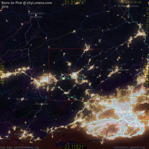
Analysis of Barra do Piraí night lights 2016
Square area 10x10 km:
 6.82%
6.82%90-99
6.63%80-89
2.27%70-79
10.61%60-69
11.17%50-59
1.7%40-49
6.25%30-39
4.55%20-29
13.45%10-19
35.23%0-9
1.33%Square area 50x50 km:
0.69%90-99
0.89%80-89
1.19%70-79
2.35%60-69
2.4%50-59
2.36%40-49
2.55%30-39
2.6%20-29
3.12%10-19
11.34%0-9
70.49%Clear (daylight) street map image can be seen on geolist.org.
Map coordinates:
21° 49' 7.5" South, 44° 31' 43.3" West
22° 28' 12" South, 43° 49' 32" West
23° 7' 5.6" South, 43° 7' 20.8" West
Some cities around Barra do Piraí sort by population:
• Volta Redonda
29.2 km =18.1 mi,  258°
258°
• Japeri
26.1 km =16.2 mi,  137°
137°
• Valença
28.1 km =17.5 mi,  27°
27°
• Paracambi
19.5 km =12.1 mi, 141°
• Vassouras
18.3 km =11.4 mi,  66°
66°
• Pinheiral
18.6 km =11.6 mi, 255°
• Piraí
19.2 km =11.9 mi,  202°
202°
• Mendes
11.4 km =7.1 mi,  123°
123°
3470691 (p: 87,668)
Sources (retrieved 2019-11-25):
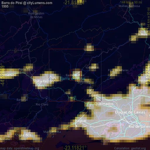
» NASA, Earths city lights 1995
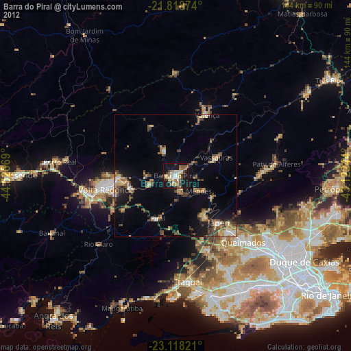
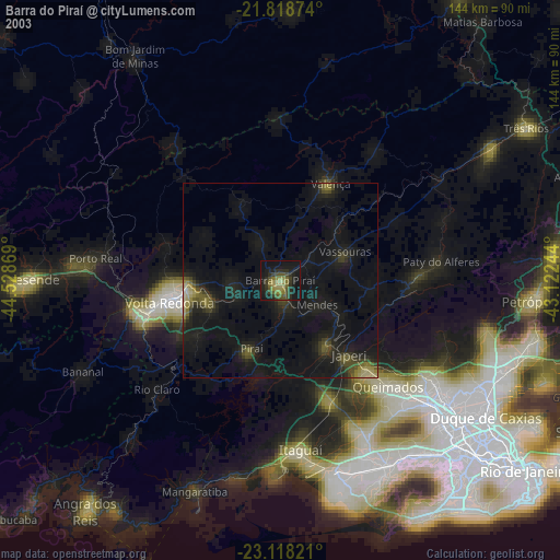
» NASA city lights 2003
» Earth at Night: Flat Maps 2012, 2016