Vratsa night lights from space
Night Light of Vratsa from space (Bulgaria) Src. Average luminocity for 10x10km area is 16.0455% and for 50x50km: 0.9756%.
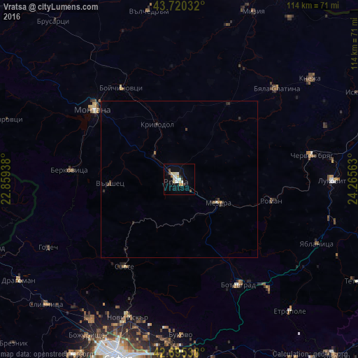

Analysis of Vratsa night lights 2016
Square area 10x10 km:
 1.52%
1.52%90-99
5%80-89
2.73%70-79
1.67%60-69
0.61%50-59
1.21%40-49
0.61%30-39
1.36%20-29
0.45%10-19
8.79%0-9
76.06%Square area 50x50 km:
0.07%90-99
0.23%80-89
0.11%70-79
0.09%60-69
0.05%50-59
0.1%40-49
0.14%30-39
0.16%20-29
0.18%10-19
0.43%0-9
98.44%Clear (daylight) street map image can be seen on geolist.org.
Map coordinates:
43° 43' 13.2" North, 22° 51' 33.8" East
43° 12' 36" North, 23° 33' 45" East
42° 41' 43.4" North, 24° 15' 56.3" East
Some cities around Vratsa sort by population:
• Montana
35.4 km =22 mi,  309°
309°
• Botevgrad
38.9 km =24.2 mi,  152°
152°
• Berkovitsa
35.4 km =22 mi,  274°
274°
• Byala Slatina
41.4 km =25.7 mi,  46°
46°
• Cherven Bryag
42.8 km =26.6 mi,  79°
79°
• Mezdra
13 km =8.1 mi,  120°
120°
• Svoge
32.1 km =19.9 mi,  212°
212°
• Varshets
22.4 km =13.9 mi, 265°
725712 (p: 64,941)
Sources (retrieved 2019-11-25):
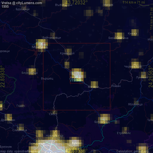
» NASA, Earths city lights 1995
» NASA city lights 2003
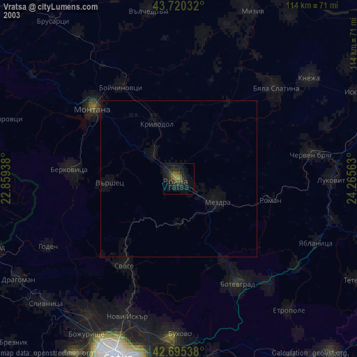
» Earth at Night: Flat Maps 2012, 2016