Popovo night lights from space
Night Light of Popovo (Targovishte) from space (Bulgaria) Src. Average luminocity for 10x10km area is 9.381% and for 50x50km: 1.2774%.
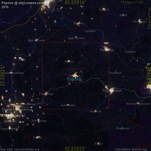
Analysis of Popovo night lights 2016
Square area 10x10 km:
 0.95%
0.95%90-99
0.79%80-89
0.16%70-79
2.06%60-69
3.65%50-59
0.63%40-49
1.9%30-39
0.63%20-29
0%10-19
0.48%0-9
88.73%Square area 50x50 km:
0.09%90-99
0.09%80-89
0.14%70-79
0.17%60-69
0.36%50-59
0.24%40-49
0.25%30-39
0.08%20-29
0.21%10-19
0.3%0-9
98.08%Clear (daylight) street map image can be seen on geolist.org.
Map coordinates:
43° 51' 32.9" North, 25° 31' 48.8" East
43° 21' 0" North, 26° 13' 60" East
42° 50' 11.6" North, 26° 56' 11.3" East
Some cities around Popovo sort by population:
• Razgrad
30.6 km =19 mi,  48°
48°
• Targovishte
29.5 km =18.3 mi,  111°
111°
• Gorna Oryahovitsa
49.7 km =30.9 mi,  240°
240°
• Omurtag
31.5 km =19.6 mi,  151°
151°
• Lyaskovets
48.8 km =30.3 mi, 237°
• Strazhitsa
25.2 km =15.7 mi, 238°
• Polski Trambesh
48.4 km =30.1 mi,  272°
272°
• Vetovo
39 km =24.2 mi,  3°
3°
728075 (p: 16,571)
Sources (retrieved 2019-11-25):
» Earth at Night: Flat Maps 2012, 2016