Dolni Dabnik night lights from space
Night Light of Dolni Dabnik (Pleven) from space (Bulgaria) Src. Average luminocity for 10x10km area is 1.4365% and for 50x50km: 2.2528%.
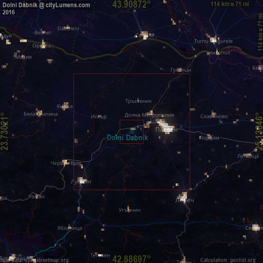
Analysis of Dolni Dabnik night lights 2016
Square area 10x10 km:
 0%
0%90-99
0%80-89
0%70-79
0%60-69
0%50-59
0.63%40-49
1.11%30-39
0.16%20-29
1.27%10-19
0%0-9
96.83%Square area 50x50 km:
0.31%90-99
0.33%80-89
0.25%70-79
0.19%60-69
0.18%50-59
0.2%40-49
0.48%30-39
0.3%20-29
0.39%10-19
2%0-9
95.38%Clear (daylight) street map image can be seen on geolist.org.
Map coordinates:
43° 54' 31.4" North, 23° 43' 48.8" East
43° 24' 0" North, 24° 25' 60" East
42° 53' 13.1" North, 25° 8' 11.3" East
Some cities around Dolni Dabnik sort by population:
• Pleven
14.9 km =9.3 mi,  82°
82°
• Lovech
37.5 km =23.3 mi,  142°
142°
• Corabia, RO
42.1 km =26.2 mi,  7°
7°
• Byala Slatina
41 km =25.5 mi,  280°
280°
• Cherven Bryag
31.4 km =19.5 mi,  244°
244°
• Lukovit
31 km =19.3 mi,  224°
224°
• Knezha
30.4 km =18.9 mi,  291°
291°
• Islaz, RO
44.5 km =27.7 mi,  36°
36°
732099 (p: 5,259)
Sources (retrieved 2019-11-25):
» Earth at Night: Flat Maps 2012, 2016