Puurs night lights from space
Night Light of Puurs (Flanders) from space (Belgium) Src. Average luminocity for 10x10km area is 61.8422% and for 50x50km: 59.8373%.
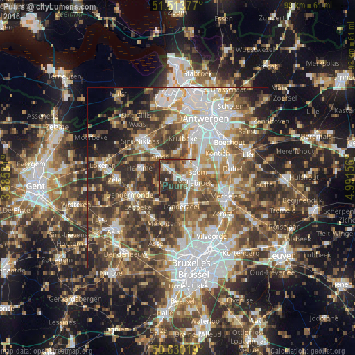
Analysis of Puurs night lights 2016
Square area 10x10 km:
100  12.7%
12.7%
90-99 14.3%
80-89 4.95%
70-79 5.75%
60-69 8.82%
50-59 14.97%
40-49 11.1%
30-39 13.77%
20-29 13.64%
10-19 0%
0-9 0%
12.7%90-99
14.3%80-89
4.95%70-79
5.75%60-69
8.82%50-59
14.97%40-49
11.1%30-39
13.77%20-29
13.64%10-19
0%0-9
0%Square area 50x50 km:
100 13.81%
90-99 12%
80-89 6.04%
70-79 7.26%
60-69 9.02%
50-59 10.25%
40-49 12.21%
30-39 10.55%
20-29 10.95%
10-19 4.28%
0-9 3.62%
13.81%90-99
12%80-89
6.04%70-79
7.26%60-69
9.02%50-59
10.25%40-49
12.21%30-39
10.55%20-29
10.95%10-19
4.28%0-9
3.62%Clear (daylight) street map image can be seen on geolist.org.
Map coordinates:
51° 30' 49.6" North, 3° 35' 7.1" East
51° 4' 26.7" North, 4° 17' 18.4" East
50° 37' 48.7" North, 4° 59' 29.6" East
Some cities around Puurs sort by population:
• Temse
7.9 km =4.9 mi,  318°
318°
• Willebroek
5.2 km =3.2 mi,  106°
106°
• Bornem
4 km =2.5 mi,  309°
309°
• Londerzeel
7.8 km =4.8 mi,  172°
172°
• Boom
6.2 km =3.9 mi,  70°
70°
• Niel
5.2 km =3.2 mi,  37°
37°
• Schelle
6.9 km =4.3 mi,  32°
32°
• Sint-Amands
5.8 km =3.6 mi,  250°
250°
2788506 (p: 15,944)
Sources (retrieved 2019-11-25):
» Earth at Night: Flat Maps 2012, 2016