Brussels night lights from space
Night Light of Brussels (Brussels Capital) from space (Belgium) Src. Average luminocity for 10x10km area is 99.6555% and for 50x50km: 53.4297%.
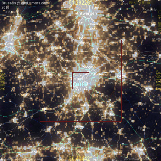
Analysis of Brussels night lights 2016
Square area 10x10 km:
 85.01%
90-99
14.43%80-89
0.28%70-79
0.28%60-69
0%50-59
0%40-49
0%30-39
0%20-29
0%10-19
0%0-9
0%Square area 50x50 km:
11.31%90-99
9.12%80-89
5.06%70-79
6.15%60-69
8.1%50-59
10.16%40-49
11.16%30-39
11.43%20-29
12.69%10-19
10.11%0-9
4.72%Clear (daylight) street map image can be seen on geolist.org.
Map coordinates:
51° 17' 32.1" North, 3° 38' 44.4" East
50° 51' 1.6" North, 4° 20' 55.6" East
50° 24' 15.9" North, 5° 3' 6.9" East
Some cities around Brussels sort by population:
• Dilbeek
6.3 km =3.9 mi,  267°
267°
• Grimbergen
9.4 km =5.8 mi,  9°
9°
• Zaventem
9.5 km =5.9 mi,  67°
67°
• Beersel
10 km =6.2 mi,  199°
199°
• Wemmel
7.1 km =4.4 mi,  334°
334°
• Kraainem
8.6 km =5.3 mi,  81°
81°
• Machelen
9.3 km =5.8 mi,  44°
44°
• Diegem
7.9 km =4.9 mi,  48°
48°
2800866 (p: 1,019,022)
Sources (retrieved 2019-11-25):
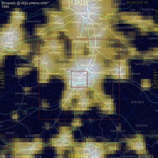
» NASA, Earths city lights 1995
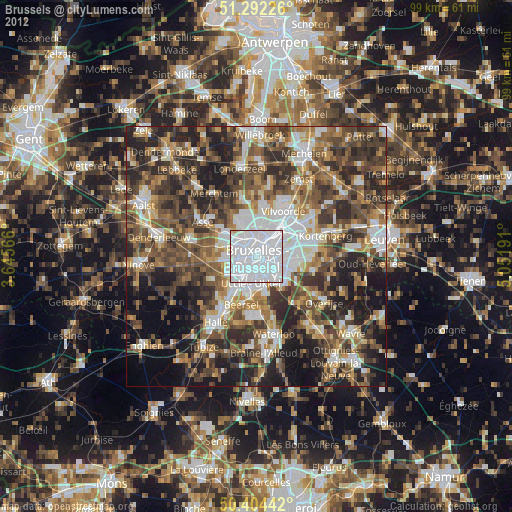
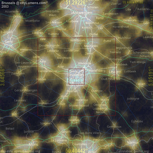
» NASA city lights 2003
» Earth at Night: Flat Maps 2012, 2016