Xocalı night lights from space
Night Light of Xocalı from space (Azerbaijan) Src. Average luminocity for 10x10km area is 0.3401% and for 50x50km: 0.9986%.
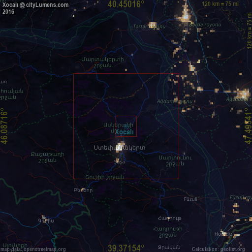
Analysis of Xocalı night lights 2016
Square area 10x10 km:
 0%
0%90-99
0%80-89
0%70-79
0%60-69
0%50-59
0%40-49
0%30-39
0%20-29
0%10-19
0.34%0-9
99.66%Square area 50x50 km:
0.13%90-99
0.14%80-89
0.1%70-79
0.01%60-69
0.21%50-59
0.13%40-49
0.2%30-39
0.07%20-29
0.21%10-19
0.47%0-9
98.34%Clear (daylight) street map image can be seen on geolist.org.
Map coordinates:
40° 27' 0.6" North, 46° 5' 13.8" East
39° 54' 46.7" North, 46° 47' 25" East
39° 22' 17.5" North, 47° 29' 36.3" East
Some cities around Xocalı sort by population:
• Xankandi
11.1 km =6.9 mi,  196°
196°
• Ağdam
14.6 km =9.1 mi,  53°
53°
• Fizuli
46.1 km =28.6 mi,  138°
138°
• Shushi
17.3 km =10.7 mi,  191°
191°
• Terter
49.2 km =30.6 mi,  14°
14°
• Martakert
33.3 km =20.7 mi,  4°
4°
• Novyy Karanlug
30.4 km =18.9 mi,  115°
115°
• Laçın
40.5 km =25.2 mi,  210°
210°
147774 (p: 5,810)
Sources (retrieved 2019-11-25):
» Earth at Night: Flat Maps 2012, 2016