Woree night lights from space
Night Light of Woree (Queensland) from space (Australia) Src. Average luminocity for 10x10km area is 53.4134% and for 50x50km: 5.7734%.
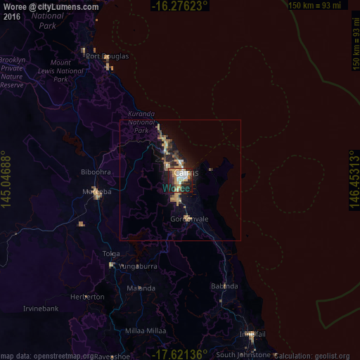
Analysis of Woree night lights 2016
Square area 10x10 km:
 10.82%
90-99
10.82%80-89
5.19%70-79
15.37%60-69
6.06%50-59
0.87%40-49
5.84%30-39
6.06%20-29
20.35%10-19
18.18%0-9
0.43%Square area 50x50 km:
0.5%90-99
0.55%80-89
0.76%70-79
1.4%60-69
0.74%50-59
0.47%40-49
0.79%30-39
0.98%20-29
1.66%10-19
4.92%0-9
87.22%Clear (daylight) street map image can be seen on geolist.org.
Map coordinates:
16° 16' 34.4" South, 145° 2' 48.8" East
16° 57' 0" South, 145° 45' 0" East
17° 37' 16.9" South, 146° 27' 11.3" East
Some cities around Woree sort by population:
• Cairns
3.4 km =2.1 mi,  30°
30°
• Mount Sheridan
4.4 km =2.7 mi,  204°
204°
• Bentley Park
6.1 km =3.8 mi,  191°
191°
• Cairns North
5.2 km =3.2 mi,  8°
8°
• Mooroobool
2.6 km =1.6 mi,  310°
310°
• Cairns City
4.1 km =2.5 mi,  37°
37°
• Manoora
3.9 km =2.4 mi,  338°
338°
• Manunda
3.6 km =2.2 mi,  358°
358°
2142902 (p: 5,351)
Sources (retrieved 2019-11-25):
» Earth at Night: Flat Maps 2012, 2016