Manunda night lights from space
Night Light of Manunda (Queensland) from space (Australia) Src. Average luminocity for 10x10km area is 57.3788% and for 50x50km: 5.7757%.
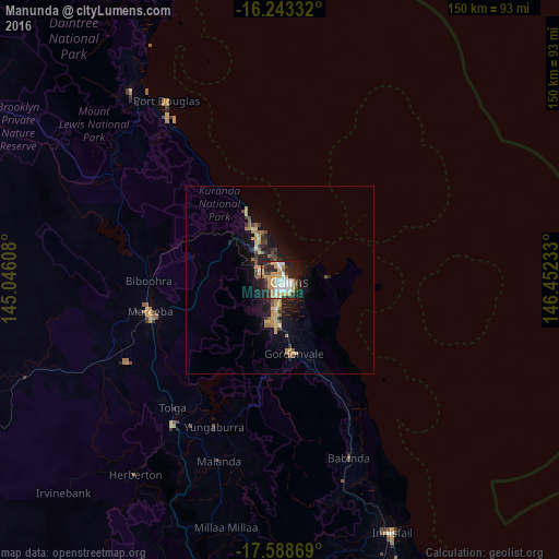
Analysis of Manunda night lights 2016
Square area 10x10 km:
 12.12%
90-99
11.69%80-89
6.28%70-79
16.88%60-69
5.41%50-59
1.52%40-49
5.63%30-39
8.66%20-29
21%10-19
10.61%0-9
0.22%Square area 50x50 km:
0.5%90-99
0.55%80-89
0.76%70-79
1.4%60-69
0.74%50-59
0.47%40-49
0.79%30-39
0.98%20-29
1.66%10-19
4.92%0-9
87.22%Clear (daylight) street map image can be seen on geolist.org.
Map coordinates:
16° 14' 36" South, 145° 2' 45.9" East
16° 55' 2" South, 145° 44' 57.1" East
17° 35' 19.3" South, 146° 27' 8.4" East
Some cities around Manunda sort by population:
• Cairns
1.9 km =1.2 mi,  111°
111°
• Redlynch
5.8 km =3.6 mi,  260°
260°
• Cairns North
1.7 km =1.1 mi,  29°
29°
• Mooroobool
2.7 km =1.7 mi,  223°
223°
• Cairns City
2.6 km =1.6 mi,  98°
98°
• Manoora
1.3 km =0.8 mi,  270°
270°
• Brinsmead
4.1 km =2.5 mi,  299°
299°
• Woree
3.6 km =2.2 mi,  178°
178°
8348896 (p: 5,638)
Sources (retrieved 2019-11-25):
» Earth at Night: Flat Maps 2012, 2016