Cairns night lights from space
Night Light of Cairns (Queensland) from space (Australia) Src. Average luminocity for 10x10km area is 52.7597% and for 50x50km: 5.7758%.
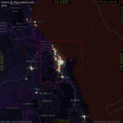
Analysis of Cairns night lights 2016
Square area 10x10 km:
 11.47%
90-99
11.04%80-89
4.76%70-79
15.8%60-69
4.55%50-59
0.87%40-49
4.98%30-39
7.58%20-29
16.23%10-19
19.26%0-9
3.46%Square area 50x50 km:
0.5%90-99
0.55%80-89
0.76%70-79
1.4%60-69
0.74%50-59
0.47%40-49
0.79%30-39
0.98%20-29
1.66%10-19
4.92%0-9
87.22%Clear (daylight) street map image can be seen on geolist.org.
Map coordinates:
16° 14' 59.3" South, 145° 3' 46.8" East
16° 55' 25.2" South, 145° 45' 58.1" East
17° 35' 42.4" South, 146° 28' 9.3" East
Some cities around Cairns sort by population:
• Redlynch
7.5 km =4.7 mi,  268°
268°
• Mount Sheridan
7.8 km =4.8 mi,  207°
207°
• Bentley Park
9.4 km =5.8 mi,  198°
198°
• Mooroobool
3.9 km =2.4 mi,  251°
251°
• Manoora
3.2 km =2 mi,  283°
283°
• Manunda
1.9 km =1.2 mi,  291°
291°
• Brinsmead
6 km =3.7 mi,  296°
296°
• Woree
3.4 km =2.1 mi, 210°
2172797 (p: 153,075)
Sources (retrieved 2019-11-25):
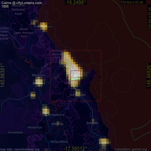
» NASA, Earths city lights 1995
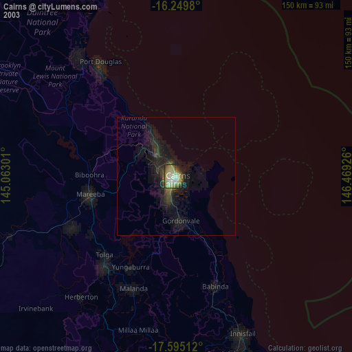
» NASA city lights 2003
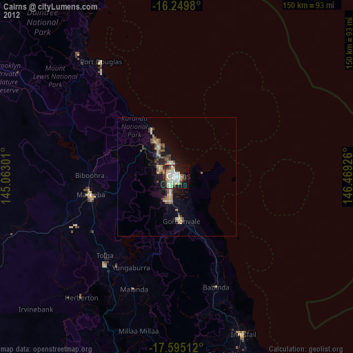
» Earth at Night: Flat Maps 2012, 2016