Ulladulla night lights from space
Night Light of Ulladulla (New South Wales) from space (Australia) Src. Average luminocity for 10x10km area is 8.7656% and for 50x50km: 0.4385%.
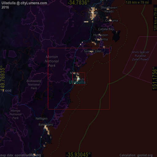
Analysis of Ulladulla night lights 2016
Square area 10x10 km:
 0.18%
0.18%90-99
0.55%80-89
0%70-79
0.73%60-69
2.93%50-59
1.47%40-49
3.66%30-39
3.66%20-29
0.92%10-19
2.01%0-9
83.88%Square area 50x50 km:
0.01%90-99
0.02%80-89
0%70-79
0.03%60-69
0.14%50-59
0.08%40-49
0.14%30-39
0.2%20-29
0.11%10-19
0.09%0-9
99.18%Clear (daylight) street map image can be seen on geolist.org.
Map coordinates:
34° 47' 1" South, 149° 46' 9.7" East
35° 21' 32.6" South, 150° 28' 20.9" East
35° 55' 49.6" South, 151° 10' 32.2" East
Some cities around Ulladulla sort by population:
• Albion Park
91.8 km =57 mi,  17°
17°
• Nowra
54.1 km =33.6 mi,  12°
12°
• Moss Vale
90 km =55.9 mi,  354°
354°
• Sanctuary Point
31.7 km =19.7 mi,  26°
26°
• Kiama
84.2 km =52.3 mi, 24°
• Bomaderry
58 km =36 mi, 12°
• North Nowra
56.5 km =35.1 mi, 9°
• Shell Cove
92.6 km =57.5 mi, 22°
2145554 (p: 6,468)
Sources (retrieved 2019-11-25):
» Earth at Night: Flat Maps 2012, 2016