Keilor Downs night lights from space
Night Light of Keilor Downs (Victoria) from space (Australia) Src. Average luminocity for 10x10km area is 81.1224% and for 50x50km: 43.9074%.
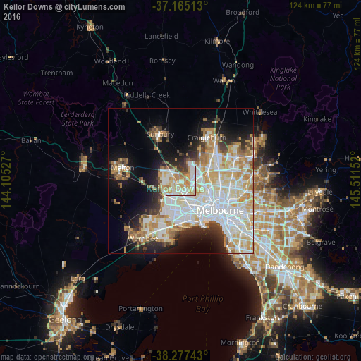
Analysis of Keilor Downs night lights 2016
Square area 10x10 km:
 17.35%
90-99
25%80-89
15.14%70-79
19.39%60-69
10.88%50-59
3.91%40-49
4.59%30-39
3.57%20-29
0.17%10-19
0%0-9
0%Square area 50x50 km:
12.91%90-99
10.91%80-89
5.51%70-79
6.58%60-69
4.86%50-59
3.23%40-49
2.86%30-39
3.17%20-29
5.36%10-19
10.18%0-9
34.44%Clear (daylight) street map image can be seen on geolist.org.
Map coordinates:
37° 9' 54.5" South, 144° 6' 19" East
37° 43' 24.1" South, 144° 48' 30.2" East
38° 16' 38.7" South, 145° 30' 41.5" East
Some cities around Keilor Downs sort by population:
• St Albans
2.5 km =1.6 mi,  196°
196°
• Saint Albans
1.3 km =0.8 mi,  213°
213°
• Taylors Lakes
3.4 km =2.1 mi,  324°
324°
• Sydenham
4.5 km =2.8 mi,  305°
305°
• Cairnlea
4.4 km =2.7 mi, 204°
• Delahey
2.8 km =1.7 mi,  278°
278°
• Kings Park
2.9 km =1.8 mi,  246°
246°
• Albanvale
4.3 km =2.7 mi,  234°
234°
9972569 (p: 9,880)
Sources (retrieved 2019-11-25):
» Earth at Night: Flat Maps 2012, 2016