Oakleigh South night lights from space
Night Light of Oakleigh South (Victoria) from space (Australia) Src. Average luminocity for 10x10km area is 89.1753% and for 50x50km: 50.4561%.
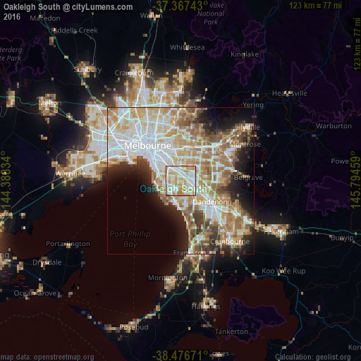
Analysis of Oakleigh South night lights 2016
Square area 10x10 km:
 27.44%
90-99
31.01%80-89
13.96%70-79
21.59%60-69
5.36%50-59
0.65%40-49
0%30-39
0%20-29
0%10-19
0%0-9
0%Square area 50x50 km:
12.92%90-99
12.04%80-89
6.21%70-79
8.78%60-69
7.66%50-59
6.05%40-49
3.95%30-39
3.66%20-29
5.63%10-19
7.52%0-9
25.58%Clear (daylight) street map image can be seen on geolist.org.
Map coordinates:
37° 22' 2.7" South, 144° 23' 18" East
37° 55' 27" South, 145° 5' 29.3" East
38° 28' 36.2" South, 145° 47' 40.5" East
Some cities around Oakleigh South sort by population:
• Bentleigh East
3.4 km =2.1 mi,  279°
279°
• Clayton
2.4 km =1.5 mi,  69°
69°
• Clayton South
2.4 km =1.5 mi,  114°
114°
• Murrumbeena
3.5 km =2.2 mi,  321°
321°
• Hughesdale
2.8 km =1.7 mi,  345°
345°
• Clarinda
2.1 km =1.3 mi,  152°
152°
• Moorabbin
3.5 km =2.2 mi,  236°
236°
• McKinnon
3.7 km =2.3 mi, 282°
7932640 (p: 9,182)
Sources (retrieved 2019-11-25):
» Earth at Night: Flat Maps 2012, 2016