Morphett Vale night lights from space
Night Light of Morphett Vale (South Australia) from space (Australia) Src. Average luminocity for 10x10km area is 53.5577% and for 50x50km: 12.8798%.
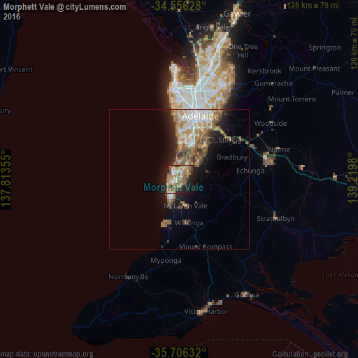
Analysis of Morphett Vale night lights 2016
Square area 10x10 km:
 6.64%
6.64%90-99
7.34%80-89
2.97%70-79
11.71%60-69
18.36%50-59
12.06%40-49
7.87%30-39
3.67%20-29
13.64%10-19
13.46%0-9
2.27%Square area 50x50 km:
2.12%90-99
1.92%80-89
0.83%70-79
2.44%60-69
2.88%50-59
2.38%40-49
1.81%30-39
1.25%20-29
2.55%10-19
6%0-9
75.81%Clear (daylight) street map image can be seen on geolist.org.
Map coordinates:
34° 33' 22.6" South, 137° 48' 48.8" East
35° 7' 60" South, 138° 31' 0" East
35° 42' 22.8" South, 139° 13' 11.3" East
Some cities around Morphett Vale sort by population:
• Hallett Cove
6 km =3.7 mi,  358°
358°
• Happy Valley
5.8 km =3.6 mi,  15°
15°
• Woodcroft
5.4 km =3.4 mi,  50°
50°
• Aberfoyle Park
9.3 km =5.8 mi, 47°
• Sheidow Park
6.1 km =3.8 mi,  9°
9°
• Seaford Rise
7.4 km =4.6 mi,  205°
205°
• Christies Beach
4.1 km =2.5 mi,  261°
261°
• Christie Downs
1.9 km =1.2 mi,  281°
281°
2065740 (p: 22,788)
Sources (retrieved 2019-11-25):
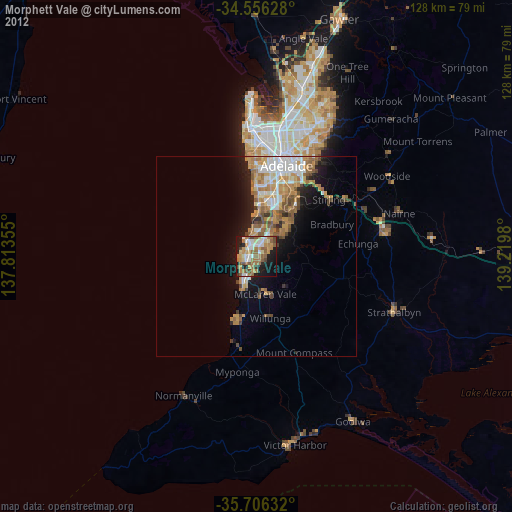
» Earth at Night: Flat Maps 2012, 2016