Seaford Rise night lights from space
Night Light of Seaford Rise (South Australia) from space (Australia) Src. Average luminocity for 10x10km area is 30.2238% and for 50x50km: 8.7588%.
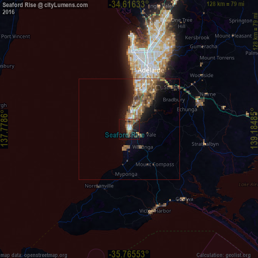
Analysis of Seaford Rise night lights 2016
Square area 10x10 km:
 2.62%
2.62%90-99
3.5%80-89
1.57%70-79
3.85%60-69
7.34%50-59
6.64%40-49
5.42%30-39
3.85%20-29
8.57%10-19
32.34%0-9
24.3%Square area 50x50 km:
0.85%90-99
1%80-89
0.41%70-79
1.68%60-69
2.39%50-59
2%40-49
1.58%30-39
1.13%20-29
1.91%10-19
5.04%0-9
82.01%Clear (daylight) street map image can be seen on geolist.org.
Map coordinates:
34° 36' 58.8" South, 137° 46' 43" East
35° 11' 34.7" South, 138° 28' 54.2" East
35° 45' 55.9" South, 139° 11' 5.5" East
Some cities around Seaford Rise sort by population:
• Morphett Vale
7.4 km =4.6 mi,  25°
25°
• Hallett Cove
13 km =8.1 mi,  13°
13°
• Happy Valley
13.1 km =8.1 mi,  21°
21°
• Woodcroft
12.5 km =7.8 mi,  36°
36°
• Aldinga Beach
9.7 km =6 mi,  192°
192°
• Sheidow Park
13.3 km =8.3 mi, 18°
• Christies Beach
6.1 km =3.8 mi,  351°
351°
• Christie Downs
7.1 km =4.4 mi, 10°
9440342 (p: 5,992)
Sources (retrieved 2019-11-25):
» Earth at Night: Flat Maps 2012, 2016