Keilor night lights from space
Night Light of Keilor (Victoria) from space (Australia) Src. Average luminocity for 10x10km area is 80.3588% and for 50x50km: 45.8421%.
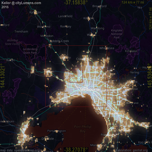
Analysis of Keilor night lights 2016
Square area 10x10 km:
 20.07%
90-99
25.34%80-89
12.76%70-79
16.84%60-69
9.18%50-59
3.91%40-49
3.74%30-39
5.44%20-29
2.72%10-19
0%0-9
0%Square area 50x50 km:
13.1%90-99
11.37%80-89
5.94%70-79
7.24%60-69
5.15%50-59
3.59%40-49
3%30-39
3.43%20-29
5.49%10-19
9.41%0-9
32.26%Clear (daylight) street map image can be seen on geolist.org.
Map coordinates:
37° 9' 30.2" South, 144° 7' 48.8" East
37° 43' 0" South, 144° 49' 60" East
38° 16' 14.8" South, 145° 32' 11.3" East
Some cities around Keilor sort by population:
• St Albans
4.3 km =2.7 mi,  222°
222°
• Saint Albans
3.5 km =2.2 mi,  237°
237°
• Taylors Lakes
4.6 km =2.9 mi,  295°
295°
• Avondale Heights
5.6 km =3.5 mi,  152°
152°
• Delahey
4.9 km =3 mi,  265°
265°
• Kings Park
5.3 km =3.3 mi,  248°
248°
• Airport West
4.3 km =2.7 mi,  101°
101°
• Tullamarine
4.5 km =2.8 mi,  67°
67°
2161719 (p: 5,730)
Sources (retrieved 2019-11-25):
» Earth at Night: Flat Maps 2012, 2016