Douglas night lights from space
Night Light of Douglas (Queensland) from space (Australia) Src. Average luminocity for 10x10km area is 73.469% and for 50x50km: 10.5314%.
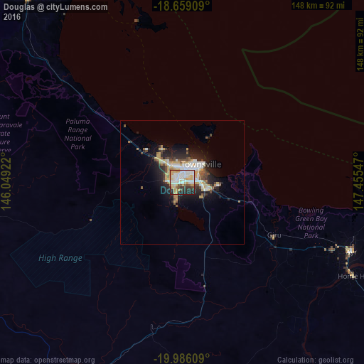
Analysis of Douglas night lights 2016
Square area 10x10 km:
 21.69%
90-99
21.9%80-89
10.74%70-79
14.46%60-69
1.65%50-59
3.93%40-49
3.72%30-39
5.99%20-29
14.05%10-19
1.86%0-9
0%Square area 50x50 km:
1.94%90-99
2.11%80-89
1.58%70-79
1.67%60-69
0.48%50-59
1.1%40-49
1.31%30-39
1.03%20-29
3.46%10-19
5.5%0-9
79.82%Clear (daylight) street map image can be seen on geolist.org.
Map coordinates:
18° 39' 32.7" South, 146° 2' 57.2" East
19° 19' 26.2" South, 146° 45' 8.4" East
19° 59' 9.9" South, 147° 27' 19.7" East
Some cities around Douglas sort by population:
• Townsville
8.5 km =5.3 mi,  41°
41°
• Kirwan
3.7 km =2.3 mi,  309°
309°
• Kelso
8.1 km =5 mi,  205°
205°
• Mount Louisa
5.6 km =3.5 mi,  358°
358°
• Annandale
4.1 km =2.5 mi,  76°
76°
• Cranbrook
2 km =1.2 mi,  1°
1°
• Condon
3.8 km =2.4 mi,  260°
260°
• Burdell
9.9 km =6.2 mi,  325°
325°
8348255 (p: 8,522)
Sources (retrieved 2019-11-25):
» Earth at Night: Flat Maps 2012, 2016