Kirchenviertel night lights from space
Night Light of Kirchenviertel (Styria) from space (Austria) Src. Average luminocity for 10x10km area is 16.2898% and for 50x50km: 6.3489%.
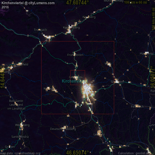
Analysis of Kirchenviertel night lights 2016
Square area 10x10 km:
 1.42%
1.42%90-99
2.41%80-89
2.41%70-79
2.13%60-69
0.99%50-59
1.56%40-49
0.28%30-39
3.41%20-29
6.96%10-19
16.62%0-9
61.79%Square area 50x50 km:
0.73%90-99
1.21%80-89
0.56%70-79
0.81%60-69
0.8%50-59
0.95%40-49
0.9%30-39
1.04%20-29
1.82%10-19
3.84%0-9
87.35%Clear (daylight) street map image can be seen on geolist.org.
Map coordinates:
47° 36' 26.8" North, 14° 38' 40.3" East
47° 7' 52.5" North, 15° 20' 51.5" East
46° 39' 2.7" North, 16° 3' 2.8" East
Some cities around Kirchenviertel sort by population:
• Lend
7.5 km =4.7 mi,  136°
136°
• Gries
9.6 km =6 mi, 142°
• Geidorf
9 km =5.6 mi,  125°
125°
• Eggenberg
7.8 km =4.8 mi,  150°
150°
• Andritz
6.1 km =3.8 mi,  108°
108°
• Wetzelsdorf
9.5 km =5.9 mi,  155°
155°
• Gösting
5.3 km =3.3 mi, 134°
• Gratkorn
0.3 km =0.2 mi,  37°
37°
11593866 (p: 5,791)
Sources (retrieved 2019-11-25):
» Earth at Night: Flat Maps 2012, 2016