Villa Paula de Sarmiento night lights from space
Night Light of Villa Paula de Sarmiento (San Juan) from space (Argentina) Src. Average luminocity for 10x10km area is 79.5262% and for 50x50km: 21.734%.
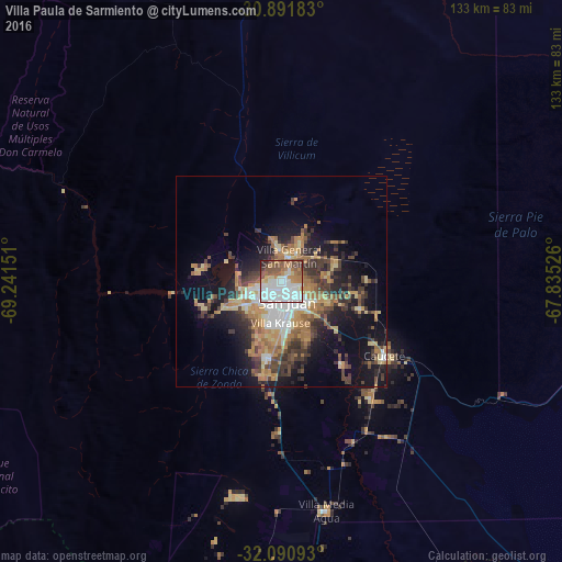
Analysis of Villa Paula de Sarmiento night lights 2016
Square area 10x10 km:
 38.29%
90-99
14.34%80-89
5.24%70-79
5.24%60-69
10.84%50-59
14.69%40-49
4.72%30-39
3.67%20-29
2.62%10-19
0.35%0-9
0%Square area 50x50 km:
3.6%90-99
2.18%80-89
2.57%70-79
3.48%60-69
4.89%50-59
2.4%40-49
3.65%30-39
4.69%20-29
4.53%10-19
10.66%0-9
57.34%Clear (daylight) street map image can be seen on geolist.org.
Map coordinates:
30° 53' 30.6" South, 69° 14' 29.4" West
31° 29' 35.9" South, 68° 32' 18.2" West
32° 5' 27.3" South, 67° 50' 6.9" West
Some cities around Villa Paula de Sarmiento sort by population:
• San Juan
4.9 km =3 mi,  177°
177°
• Chimbas
1.2 km =0.7 mi,  23°
23°
• Santa Lucía
6.6 km =4.1 mi,  141°
141°
• Pocito
21.6 km =13.4 mi,  191°
191°
• Caucete
30.1 km =18.7 mi,  125°
125°
• Albardón
6.4 km =4 mi,  11°
11°
• San Martín
7.9 km =4.9 mi,  26°
26°
• Nueve de Julio
24.1 km =15 mi, 144°
3832653 (p: 19,092)
Sources (retrieved 2019-11-25):
» Earth at Night: Flat Maps 2012, 2016