San Martín night lights from space
Night Light of San Martín (San Juan) from space (Argentina) Src. Average luminocity for 10x10km area is 48.5175% and for 50x50km: 19.6279%.
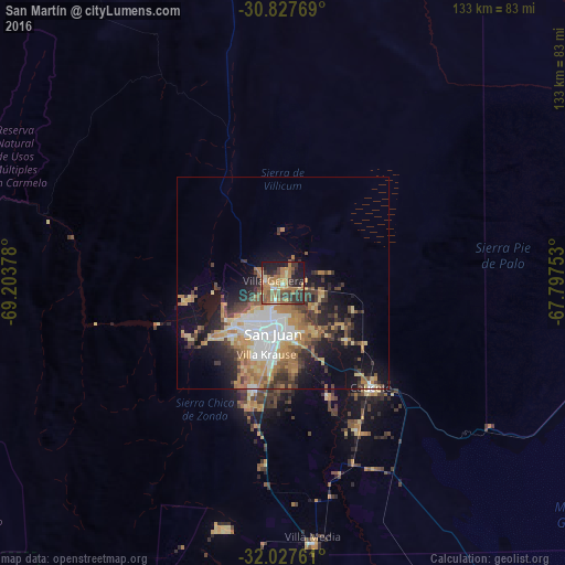
Analysis of San Martín night lights 2016
Square area 10x10 km:
 1.22%
1.22%90-99
3.15%80-89
7.17%70-79
9.09%60-69
18.88%50-59
11.36%40-49
7.69%30-39
12.59%20-29
12.24%10-19
15.73%0-9
0.87%Square area 50x50 km:
3.53%90-99
2.06%80-89
2.37%70-79
3.31%60-69
4.55%50-59
2.29%40-49
2.67%30-39
3.84%20-29
3.91%10-19
8.65%0-9
62.82%Clear (daylight) street map image can be seen on geolist.org.
Map coordinates:
30° 49' 39.7" South, 69° 12' 13.6" West
31° 25' 46.5" South, 68° 30' 2.3" West
32° 1' 39.4" South, 67° 47' 51.1" West
Some cities around San Martín sort by population:
• San Juan
12.5 km =7.8 mi,  195°
195°
• Chimbas
6.7 km =4.2 mi,  207°
207°
• Santa Lucía
12.3 km =7.6 mi,  177°
177°
• Pocito
29.3 km =18.2 mi, 195°
• Caucete
32.3 km =20.1 mi,  139°
139°
• Albardón
2.5 km =1.6 mi,  250°
250°
• Villa Paula de Sarmiento
7.9 km =4.9 mi, 206°
• Nueve de Julio
28.6 km =17.8 mi,  158°
158°
3836993 (p: 10,140)
Sources (retrieved 2019-11-25):
» Earth at Night: Flat Maps 2012, 2016