San Pedro de Jujuy night lights from space
Night Light of San Pedro de Jujuy (Jujuy) from space (Argentina) Src. Average luminocity for 10x10km area is 27.0663% and for 50x50km: 2.3282%.
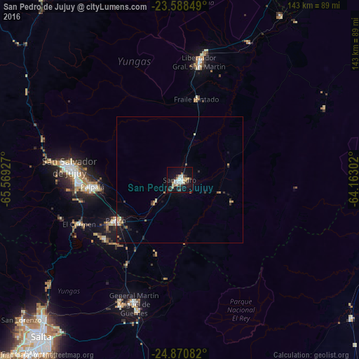

Analysis of San Pedro de Jujuy night lights 2016
Square area 10x10 km:
 3.41%
3.41%90-99
5.3%80-89
5.87%70-79
2.65%60-69
1.7%50-59
0.57%40-49
3.22%30-39
7.2%20-29
0.76%10-19
30.11%0-9
39.2%Square area 50x50 km:
0.18%90-99
0.25%80-89
0.46%70-79
0.37%60-69
0.16%50-59
0.14%40-49
0.24%30-39
0.6%20-29
0.28%10-19
2.09%0-9
95.22%Clear (daylight) street map image can be seen on geolist.org.
Map coordinates:
23° 35' 18.6" South, 65° 34' 9.4" West
24° 13' 52.6" South, 64° 51' 58.1" West
24° 52' 15" South, 64° 9' 46.9" West
Some cities around San Pedro de Jujuy sort by population:
• San Salvador de Jujuy
43.9 km =27.3 mi,  275°
275°
• Libertador General San Martín
47.9 km =29.8 mi,  9°
9°
• Palpalá
35.1 km =21.8 mi,  265°
265°
• Fraile Pintado
33 km =20.5 mi, 11°
• Caimancito
61.2 km =38 mi,  26°
26°
• Palma Sola
63.7 km =39.6 mi,  63°
63°
• Calilegua
51.8 km =32.2 mi, 10°
• Ingenio La Esperanza
2.8 km =1.7 mi,  76°
76°
3836772 (p: 58,430)
Sources (retrieved 2019-11-25):
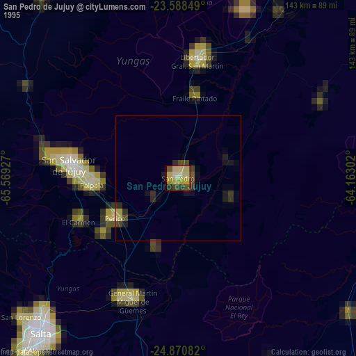
» NASA, Earths city lights 1995
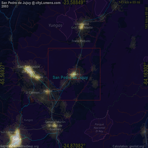
» NASA city lights 2003
» Earth at Night: Flat Maps 2012, 2016