Pilar night lights from space
Night Light of Pilar (Buenos Aires) from space (Argentina) Src. Average luminocity for 10x10km area is 73.3741% and for 50x50km: 49.3618%.
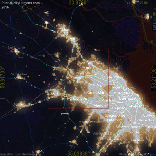
Analysis of Pilar night lights 2016
Square area 10x10 km:
 15.73%
90-99
15.73%80-89
6.82%70-79
15.91%60-69
16.43%50-59
16.78%40-49
7.52%30-39
3.85%20-29
1.22%10-19
0%0-9
0%Square area 50x50 km:
12.61%90-99
10.23%80-89
5.56%70-79
7.15%60-69
7.18%50-59
8.49%40-49
4.31%30-39
4.17%20-29
7.5%10-19
12.73%0-9
20.08%Clear (daylight) street map image can be seen on geolist.org.
Map coordinates:
33° 52' 36.8" South, 59° 37' 2.4" West
34° 27' 31.2" South, 58° 54' 51.1" West
35° 2' 11" South, 58° 12' 39.9" West
Some cities around Pilar sort by population:
• José C. Paz
14.8 km =9.2 mi,  115°
115°
• San Miguel
20.8 km =12.9 mi, 116°
• Luján
21.4 km =13.3 mi,  234°
234°
• Los Polvorines
19.7 km =12.2 mi,  104°
104°
• Villa de Mayo
22.2 km =13.8 mi,  105°
105°
• Tortuguitas
14.8 km =9.2 mi, 97°
• Ingeniero Pablo Nogués
19.2 km =11.9 mi, 96°
• Muñiz
21.8 km =13.5 mi, 119°
3429980 (p: 226,517)
Sources (retrieved 2019-11-25):
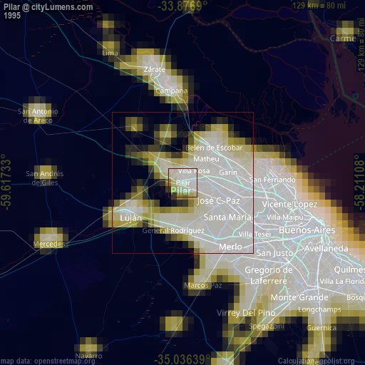
» NASA, Earths city lights 1995
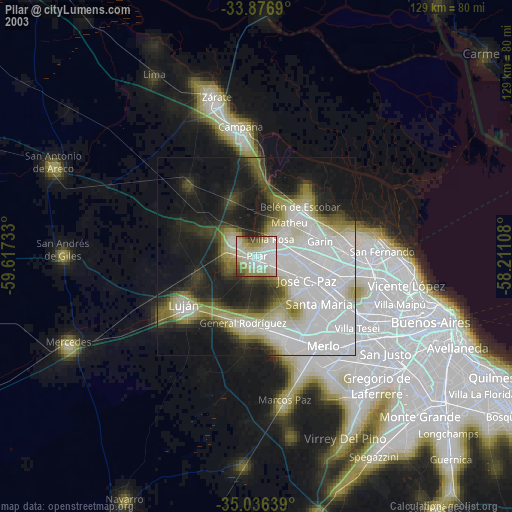
» NASA city lights 2003
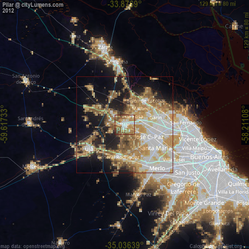
» Earth at Night: Flat Maps 2012, 2016