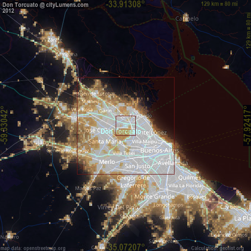
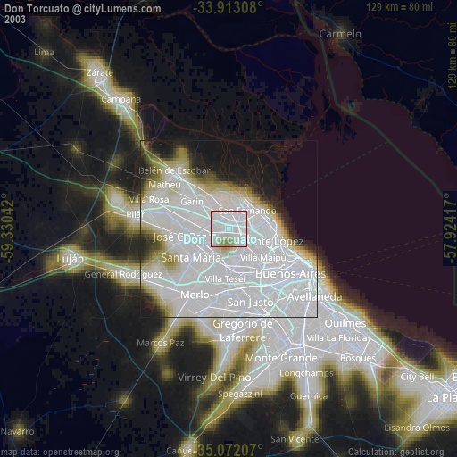
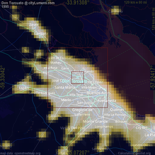
Don Torcuato night lights from space
Night Light of Don Torcuato (Buenos Aires) from space (Argentina) Src. Average luminocity for 10x10km area is 92.2203% and for 50x50km: 65.2467%.
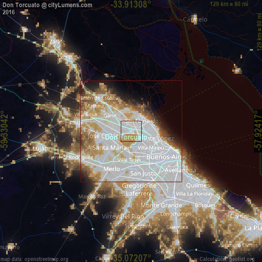
Analysis of Don Torcuato night lights 2016
Square area 10x10 km:
 43.88%
90-99
26.4%80-89
5.07%70-79
24.13%60-69
0.52%50-59
0%40-49
0%30-39
0%20-29
0%10-19
0%0-9
0%Square area 50x50 km:
33.26%90-99
14.23%80-89
4.8%70-79
6.6%60-69
5.13%50-59
4.57%40-49
2.5%30-39
1.89%20-29
2.88%10-19
4.69%0-9
19.44%Clear (daylight) street map image can be seen on geolist.org.
Map coordinates:
33° 54' 47.1" South, 59° 19' 49.5" West
34° 29' 40.5" South, 58° 37' 38.2" West
35° 4' 19.5" South, 57° 55' 27" West
Some cities around Don Torcuato sort by population:
• San Miguel
9.5 km =5.9 mi,  235°
235°
• Los Polvorines
7.3 km =4.5 mi,  262°
262°
• San Isidro
9.5 km =5.9 mi,  74°
74°
• Villa de Mayo
5.2 km =3.2 mi,  249°
249°
• General Pacheco
4.9 km =3 mi,  342°
342°
• Ingeniero Pablo Nogués
7.5 km =4.7 mi,  284°
284°
• Tigre
8.8 km =5.5 mi,  29°
29°
• Muñiz
10 km =6.2 mi,  226°
226°
3435010 (p: 64,867)
Sources (retrieved 2019-11-25):
» NASA, Earths city lights 1995
» NASA city lights 2003
» Earth at Night: Flat Maps 2012, 2016