N'zeto night lights from space
Night Light of N'zeto (Zaire) from space (Angola) Src. Average luminocity for 10x10km area is 2.4307% and for 50x50km: 0.0972%.
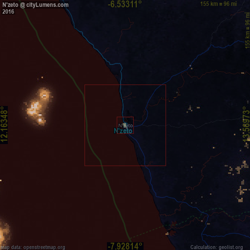
Analysis of N'zeto night lights 2016
Square area 10x10 km:
 0%
0%90-99
0%80-89
0%70-79
0%60-69
0%50-59
0%40-49
3.46%30-39
1.08%20-29
1.3%10-19
0.22%0-9
93.94%Square area 50x50 km:
0%90-99
0%80-89
0%70-79
0%60-69
0%50-59
0%40-49
0.14%30-39
0.04%20-29
0.05%10-19
0.01%0-9
99.76%Clear (daylight) street map image can be seen on geolist.org.
Map coordinates:
6° 31' 59.2" South, 12° 9' 48.5" East
7° 13' 52.2" South, 12° 51' 59.8" East
7° 55' 41.3" South, 13° 34' 11" East
Some cities around N'zeto sort by population:
• Luanda
183.1 km =113.8 mi,  167°
167°
• Matadi, CD
168.3 km =104.6 mi,  23°
23°
• Boma, CD
154.8 km =96.2 mi,  7°
7°
• Soio
133.7 km =83.1 mi,  335°
335°
• Cabinda
200.9 km =124.8 mi, 338°
• Moanda, CD
154.9 km =96.3 mi, 339°
• Caxito
173.7 km =107.9 mi,  149°
149°
• Mbanza Congo
185.7 km =115.4 mi,  54°
54°
2239001 (p: 18,352)
Sources (retrieved 2019-11-25):
» Earth at Night: Flat Maps 2012, 2016