Durrës night lights from space
Night Light of Durrës from space (Albania) Src. Average luminocity for 10x10km area is 43.0187% and for 50x50km: 7.5411%.
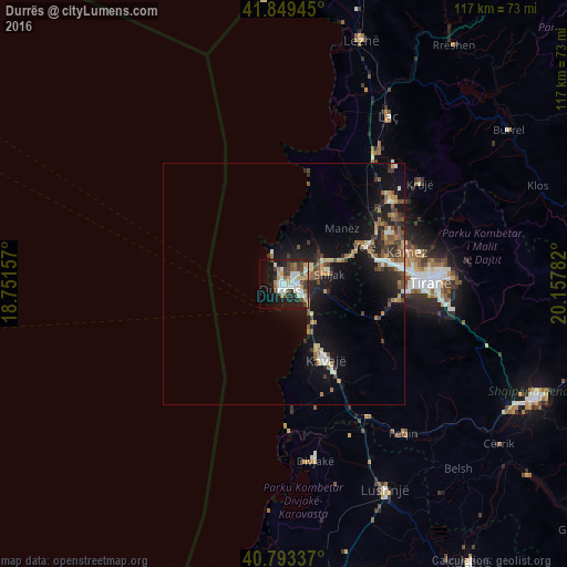
Analysis of Durrës night lights 2016
Square area 10x10 km:
 8.67%
8.67%90-99
11.22%80-89
4.25%70-79
4.42%60-69
4.76%50-59
4.25%40-49
5.1%30-39
7.14%20-29
9.52%10-19
23.47%0-9
17.18%Square area 50x50 km:
0.71%90-99
1.08%80-89
0.55%70-79
0.79%60-69
1.27%50-59
1.36%40-49
1.12%30-39
1.33%20-29
2.2%10-19
6.82%0-9
82.77%Clear (daylight) street map image can be seen on geolist.org.
Map coordinates:
41° 50' 58" North, 18° 45' 5.7" East
41° 19' 24.8" North, 19° 27' 16.9" East
40° 47' 36.1" North, 20° 9' 28.2" East
Some cities around Durrës sort by population:
• Tirana
30.4 km =18.9 mi,  89°
89°
• Kavajë
17.6 km =10.9 mi,  150°
150°
• Krujë
34.9 km =21.7 mi,  53°
53°
• Shijak
9.7 km =6 mi,  75°
75°
• Kamëz
26.3 km =16.3 mi, 75°
• Fushë-Krujë
27.9 km =17.3 mi, 51°
• Mamurras
34.5 km =21.4 mi,  35°
35°
• Rrogozhinë
32.6 km =20.3 mi, 147°
3185728 (p: 122,034)
Sources (retrieved 2019-11-25):
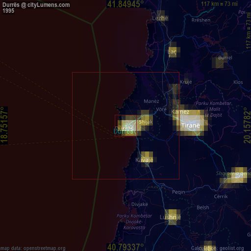
» NASA, Earths city lights 1995
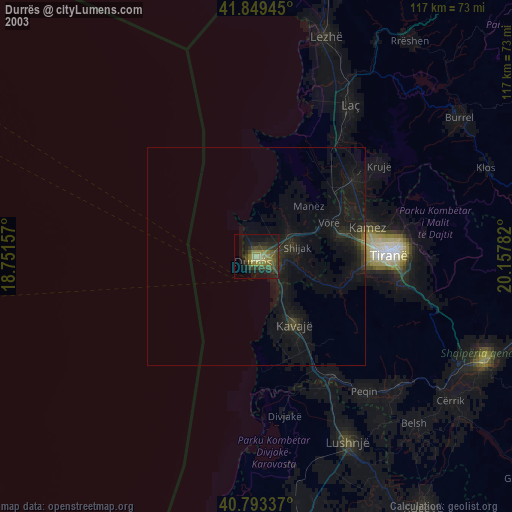
» NASA city lights 2003
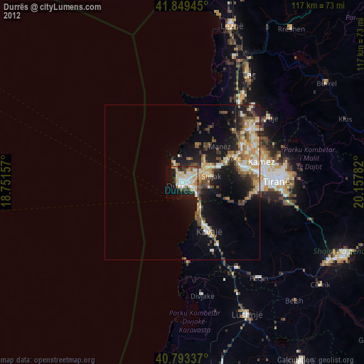
» Earth at Night: Flat Maps 2012, 2016