Johannesburg night lights from space
Night Light of Johannesburg (Gauteng) from space (South Africa) Src. Average luminocity for 10x10km area is 99.3512% and for 50x50km: 85.2224%.
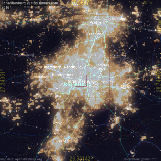
Analysis of Johannesburg night lights 2016
Square area 10x10 km:
 67.66%
90-99
31.35%80-89
0.99%70-79
0%60-69
0%50-59
0%40-49
0%30-39
0%20-29
0%10-19
0%0-9
0%Square area 50x50 km:
32.51%90-99
25.28%80-89
13.44%70-79
10.77%60-69
5.4%50-59
4.69%40-49
3.21%30-39
1.67%20-29
2.11%10-19
0.86%0-9
0.05%Clear (daylight) street map image can be seen on geolist.org.
Map coordinates:
25° 34' 10.9" South, 27° 20' 25.8" East
26° 12' 8.2" South, 28° 2' 37.1" East
26° 49' 53.1" South, 28° 44' 48.3" East
Fantastic image of Johannesburg from space taken by astronauts [src2], but I don't have information about it's orientation, scale or angle. If necessary, it was rotated manually, so North points approximately to upper direction. Click to zoom in:

Some cities around Johannesburg sort by population:
• Randburg
12.8 km =8 mi,  340°
340°
• Roodepoort
17.6 km =10.9 mi,  284°
284°
• Alberton
10.7 km =6.6 mi,  132°
132°
• Edenvale
12.8 km =8 mi,  57°
57°
• Eden Glen
14.7 km =9.1 mi, 58°
• Eastleigh
13.8 km =8.6 mi,  54°
54°
• Eden Glen Ext 60
14.8 km =9.2 mi, 54°
• Riverlea
7.1 km =4.4 mi,  261°
261°
993800 (p: 2,026,469)
Sources (retrieved 2019-11-25):
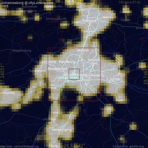
» NASA, Earths city lights 1995
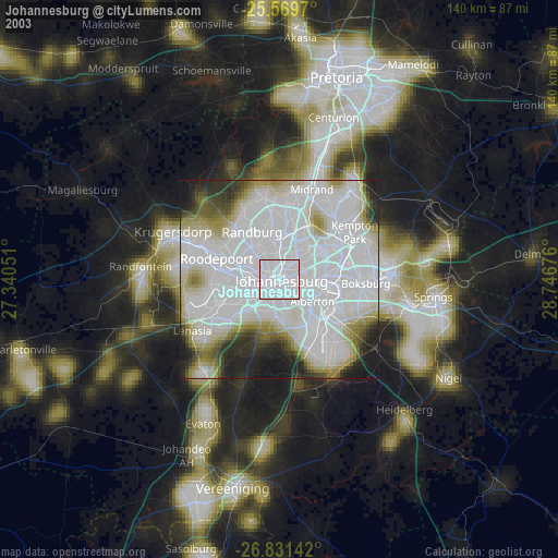
» NASA city lights 2003
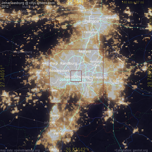
» Earth at Night: Flat Maps 2012, 2016
Src.2: NASA.gov