White Oak night lights from space
Night Light of White Oak (Ohio) from space (United States) Src. Average luminocity for 10x10km area is 74.8844% and for 50x50km: 56.2571%.
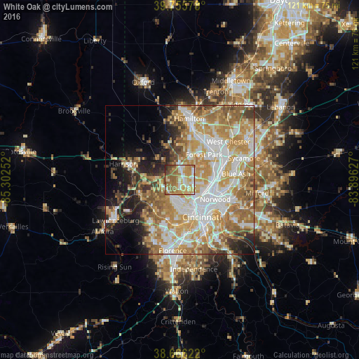
Analysis of White Oak night lights 2016
Square area 10x10 km:
 10.54%
90-99
15.14%80-89
14.97%70-79
18.37%60-69
23.47%50-59
9.86%40-49
5.1%30-39
1.02%20-29
1.53%10-19
0%0-9
0%Square area 50x50 km:
12.07%90-99
12.66%80-89
7.83%70-79
11.5%60-69
10.93%50-59
7.36%40-49
3.85%30-39
3.71%20-29
4.82%10-19
8.25%0-9
17.03%Clear (daylight) street map image can be seen on geolist.org.
Map coordinates:
39° 45' 20.8" North, 85° 18' 9.1" West
39° 12' 47.2" North, 84° 35' 57.8" West
38° 39' 58.4" North, 83° 53' 46.6" West
Some cities around White Oak sort by population:
• Monfort Heights
2.8 km =1.7 mi,  172°
172°
• Northbrook
3.9 km =2.4 mi,  20°
20°
• Dent
5.4 km =3.4 mi,  235°
235°
• North College Hill
4.2 km =2.6 mi,  82°
82°
• Northgate
4.5 km =2.8 mi,  7°
7°
• Groesbeck
1.5 km =0.9 mi,  44°
44°
• Mount Healthy
5.2 km =3.2 mi,  63°
63°
• New Burlington
6.3 km =3.9 mi, 35°
4528259 (p: 19,167)
Sources (retrieved 2019-11-25):
» Earth at Night: Flat Maps 2012, 2016