Toms River night lights from space
Night Light of Toms River (New Jersey) from space (United States) Src. Average luminocity for 10x10km area is 68.2874% and for 50x50km: 25.4133%.
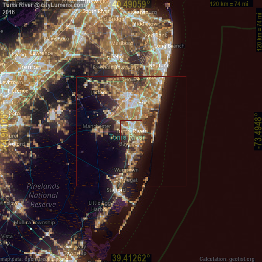
Analysis of Toms River night lights 2016
Square area 10x10 km:
 10.88%
90-99
12.41%80-89
10.03%70-79
13.44%60-69
19.39%50-59
14.97%40-49
5.27%30-39
4.59%20-29
7.14%10-19
1.87%0-9
0%Square area 50x50 km:
2.07%90-99
3.18%80-89
3.89%70-79
4.61%60-69
6.78%50-59
5.39%40-49
3.46%30-39
3.68%20-29
5.77%10-19
9.46%0-9
51.72%Clear (daylight) street map image can be seen on geolist.org.
Map coordinates:
40° 29' 26.1" North, 74° 54' 3.8" West
39° 57' 13.4" North, 74° 11' 52.5" West
39° 24' 45.4" North, 73° 29' 41.3" West
Some cities around Toms River sort by population:
• Lakewood
16.1 km =10 mi,  354°
354°
• Bayville
6.2 km =3.9 mi,  143°
143°
• Point Pleasant
18.1 km =11.2 mi,  37°
37°
• Holiday City-Berkeley
6.9 km =4.3 mi,  279°
279°
• Beachwood
1.7 km =1.1 mi,  165°
165°
• Pine Lake Park
7.4 km =4.6 mi,  317°
317°
• Crestwood Village
13.9 km =8.6 mi,  267°
267°
• Forked River
12.7 km =7.9 mi,  176°
176°
4504476 (p: 88,791)
Sources (retrieved 2019-11-25):
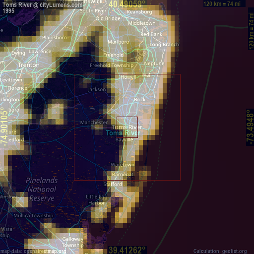
» NASA, Earths city lights 1995
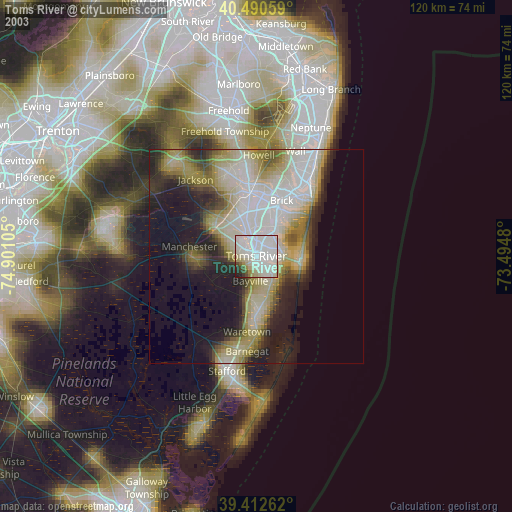
» NASA city lights 2003
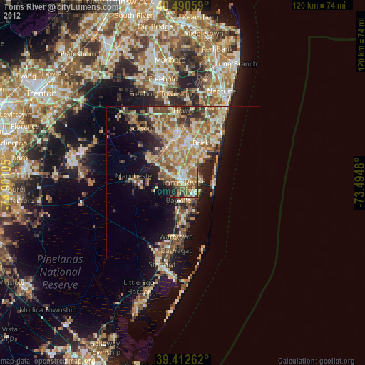
» Earth at Night: Flat Maps 2012, 2016