Strongsville night lights from space
Night Light of Strongsville (Ohio) from space (United States) Src. Average luminocity for 10x10km area is 74.8316% and for 50x50km: 54.2675%.
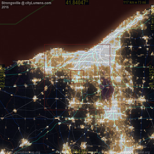

Analysis of Strongsville night lights 2016
Square area 10x10 km:
 12.24%
90-99
13.1%80-89
12.59%70-79
22.45%60-69
24.49%50-59
5.44%40-49
6.97%30-39
2.21%20-29
0.51%10-19
0%0-9
0%Square area 50x50 km:
16.23%90-99
10.38%80-89
5.25%70-79
6.21%60-69
10.14%50-59
6.67%40-49
5.41%30-39
5.78%20-29
10.42%10-19
10.49%0-9
13.01%Clear (daylight) street map image can be seen on geolist.org.
Map coordinates:
41° 50' 25.7" North, 82° 32' 19.8" West
41° 18' 52.2" North, 81° 50' 8.5" West
40° 47' 3.3" North, 81° 7' 57.3" West
Some cities around Strongsville sort by population:
• Brunswick
8.5 km =5.3 mi,  183°
183°
• North Royalton
9.3 km =5.8 mi,  90°
90°
• Parma Heights
10.5 km =6.5 mi,  37°
37°
• Broadview Heights
12.6 km =7.8 mi, 90°
• Berea
6 km =3.7 mi,  344°
344°
• Brook Park
9.7 km =6 mi,  15°
15°
• Middleburg Heights
5.6 km =3.5 mi, 20°
• Olmsted Falls
9.1 km =5.7 mi,  318°
318°
5173237 (p: 44,668)
Sources (retrieved 2019-11-25):
» Earth at Night: Flat Maps 2012, 2016