Socorro night lights from space
Night Light of Socorro (New Mexico) from space (United States) Src. Average luminocity for 10x10km area is 22.278% and for 50x50km: 1.0712%.
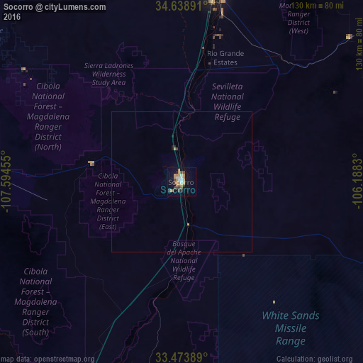
Analysis of Socorro night lights 2016
Square area 10x10 km:
 2.1%
2.1%90-99
2.45%80-89
0.7%70-79
8.57%60-69
2.97%50-59
1.75%40-49
4.9%30-39
1.75%20-29
1.4%10-19
14.86%0-9
58.57%Square area 50x50 km:
0.09%90-99
0.1%80-89
0.03%70-79
0.4%60-69
0.13%50-59
0.07%40-49
0.23%30-39
0.07%20-29
0.1%10-19
0.68%0-9
98.11%Clear (daylight) street map image can be seen on geolist.org.
Map coordinates:
34° 38' 20.1" North, 107° 35' 40.4" West
34° 3' 30.2" North, 106° 53' 29.1" West
33° 28' 26" North, 106° 11' 17.9" West
Some cities around Socorro sort by population:
• Albuquerque
116.2 km =72.2 mi,  10°
10°
• South Valley
107.6 km =66.9 mi, 10°
• Los Lunas
84.4 km =52.4 mi, 9°
• Belen
68 km =42.3 mi, 8°
• Truth or Consequences
108.7 km =67.5 mi,  197°
197°
• Los Ranchos de Albuquerque
124.8 km =77.5 mi, 10°
• Lee Acres
123.3 km =76.6 mi, 10°
• Los Chavez
75.2 km =46.7 mi, 9°
5491999 (p: 8,722)
Sources (retrieved 2019-11-25):
» Earth at Night: Flat Maps 2012, 2016