Payette night lights from space
Night Light of Payette (Idaho) from space (United States) Src. Average luminocity for 10x10km area is 17.0424% and for 50x50km: 2.1618%.
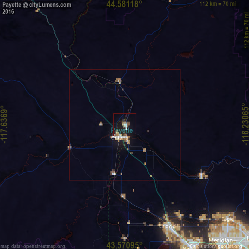
Analysis of Payette night lights 2016
Square area 10x10 km:
 1.67%
1.67%90-99
1.36%80-89
1.52%70-79
2.12%60-69
1.82%50-59
4.09%40-49
3.18%30-39
0.91%20-29
3.33%10-19
23.33%0-9
56.67%Square area 50x50 km:
0.25%90-99
0.27%80-89
0.17%70-79
0.3%60-69
0.37%50-59
0.4%40-49
0.33%30-39
0.19%20-29
0.27%10-19
1.71%0-9
95.75%Clear (daylight) street map image can be seen on geolist.org.
Map coordinates:
44° 34' 52.2" North, 117° 38' 12.8" West
44° 4' 41.6" North, 116° 56' 1.6" West
43° 34' 15.4" North, 116° 13' 50.3" West
Some cities around Payette sort by population:
• Caldwell
50.2 km =31.2 mi,  156°
156°
• Eagle
63 km =39.1 mi,  132°
132°
• Ontario
6.2 km =3.9 mi,  202°
202°
• Star
55.6 km =34.5 mi,  140°
140°
• Middleton
48.3 km =30 mi,  148°
148°
• Emmett
41.6 km =25.8 mi,  123°
123°
• Weiser
19.4 km =12.1 mi,  351°
351°
• Fruitland
8 km =5 mi,  170°
170°
5603393 (p: 7,380)
Sources (retrieved 2019-11-25):
» Earth at Night: Flat Maps 2012, 2016