Ontario night lights from space
Night Light of Ontario (Oregon) from space (United States) Src. Average luminocity for 10x10km area is 28.9302% and for 50x50km: 2.1105%.
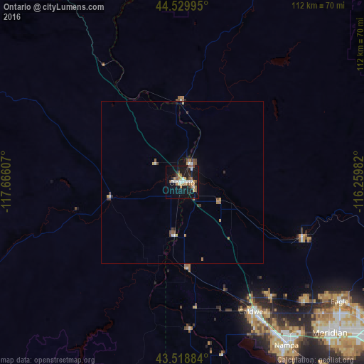
Analysis of Ontario night lights 2016
Square area 10x10 km:
 4.76%
4.76%90-99
3.97%80-89
2.06%70-79
5.24%60-69
5.08%50-59
3.81%40-49
2.06%30-39
1.75%20-29
4.13%10-19
36.67%0-9
30.48%Square area 50x50 km:
0.24%90-99
0.26%80-89
0.17%70-79
0.31%60-69
0.35%50-59
0.35%40-49
0.31%30-39
0.21%20-29
0.25%10-19
1.69%0-9
95.85%Clear (daylight) street map image can be seen on geolist.org.
Map coordinates:
44° 31' 47.8" North, 117° 39' 57.9" West
44° 1' 35.6" North, 116° 57' 46.6" West
43° 31' 7.8" North, 116° 15' 35.4" West
Some cities around Ontario sort by population:
• Caldwell
46.1 km =28.6 mi,  151°
151°
• Eagle
61.1 km =38 mi,  127°
127°
• Star
52.9 km =32.9 mi, 134°
• Payette
6.2 km =3.9 mi,  22°
22°
• Middleton
44.9 km =27.9 mi,  142°
142°
• Emmett
40.8 km =25.4 mi,  114°
114°
• Weiser
25 km =15.5 mi,  358°
358°
• Fruitland
4.3 km =2.7 mi,  119°
119°
5744166 (p: 10,999)
Sources (retrieved 2019-11-25):
» Earth at Night: Flat Maps 2012, 2016