Nampa night lights from space
Night Light of Nampa (Idaho) from space (United States) Src. Average luminocity for 10x10km area is 49.0524% and for 50x50km: 18.9359%.
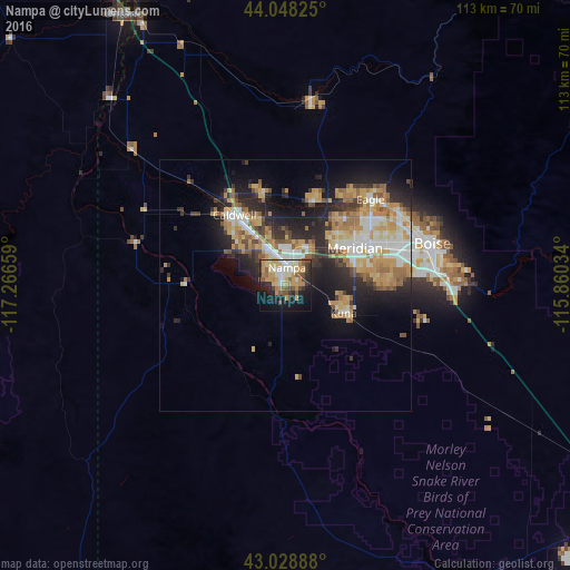
Analysis of Nampa night lights 2016
Square area 10x10 km:
 5.08%
5.08%90-99
8.57%80-89
9.05%70-79
15.87%60-69
3.02%50-59
7.62%40-49
6.03%30-39
3.81%20-29
10.95%10-19
21.59%0-9
8.41%Square area 50x50 km:
2.66%90-99
3.14%80-89
2.81%70-79
3.99%60-69
2.92%50-59
2.35%40-49
1.65%30-39
2.36%20-29
5.4%10-19
8.84%0-9
63.87%Clear (daylight) street map image can be seen on geolist.org.
Map coordinates:
44° 2' 53.7" North, 117° 15' 59.7" West
43° 32' 26.6" North, 116° 33' 48.5" West
43° 1' 44" North, 115° 51' 37.2" West
Some cities around Nampa sort by population:
• Boise
30.1 km =18.7 mi,  74°
74°
• Meridian
16 km =9.9 mi,  60°
60°
• Caldwell
16.9 km =10.5 mi,  323°
323°
• Eagle
24.1 km =15 mi,  44°
44°
• Kuna
12.8 km =8 mi,  115°
115°
• Garden City
27.7 km =17.2 mi, 70°
• Star
17.8 km =11.1 mi,  18°
18°
• Middleton
19 km =11.8 mi,  346°
346°
5601933 (p: 89,839)
Sources (retrieved 2019-11-25):
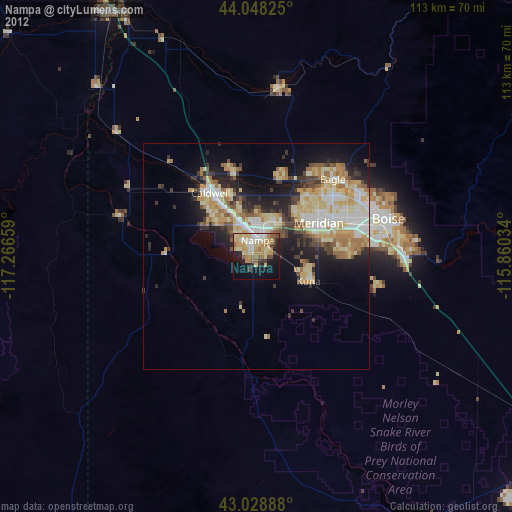
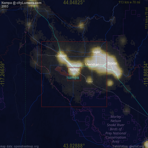
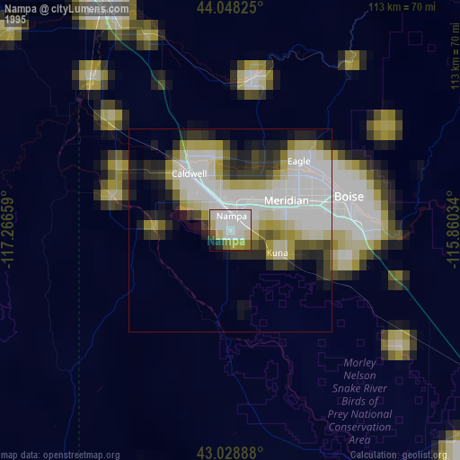
» NASA, Earths city lights 1995
» NASA city lights 2003
» Earth at Night: Flat Maps 2012, 2016