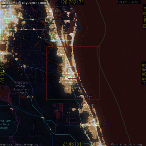
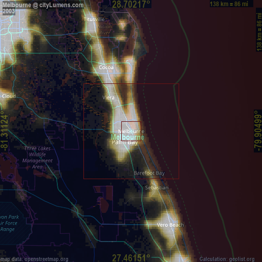
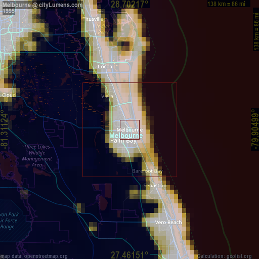
Melbourne night lights from space
Night Light of Melbourne (Florida) from space (United States) Src. Average luminocity for 10x10km area is 73.625% and for 50x50km: 18.3207%.
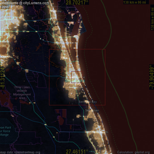
Analysis of Melbourne night lights 2016
Square area 10x10 km:
 17.61%
90-99
18.75%80-89
13.64%70-79
10.42%60-69
11.55%50-59
8.14%40-49
4.55%30-39
10.04%20-29
4.36%10-19
0.95%0-9
0%Square area 50x50 km:
1.86%90-99
2.23%80-89
1.72%70-79
2.49%60-69
6.2%50-59
3.67%40-49
2.66%30-39
2.51%20-29
4.17%10-19
8.9%0-9
63.59%Clear (daylight) street map image can be seen on geolist.org.
Map coordinates:
28° 42' 7.8" North, 81° 18' 40.5" West
28° 5' 1.1" North, 80° 36' 29.2" West
27° 27' 41.4" North, 79° 54' 18" West
Some cities around Melbourne sort by population:
• Palm Bay
5.8 km =3.6 mi,  160°
160°
• West Melbourne
4.6 km =2.9 mi,  253°
253°
• Viera East
22.4 km =13.9 mi,  332°
332°
• Satellite Beach
10.4 km =6.5 mi,  9°
9°
• Micco
24.9 km =15.5 mi,  154°
154°
• Indian Harbour Beach
7.5 km =4.7 mi, 14°
• Viera West
21.8 km =13.5 mi, 325°
• South Patrick Shores
13.2 km =8.2 mi,  359°
359°
4163971 (p: 80,127)
Sources (retrieved 2019-11-25):
» NASA, Earths city lights 1995
» NASA city lights 2003
» Earth at Night: Flat Maps 2012, 2016