Cut Off night lights from space
Night Light of Cut Off (Louisiana) from space (United States) Src. Average luminocity for 10x10km area is 32.4034% and for 50x50km: 8.6423%.
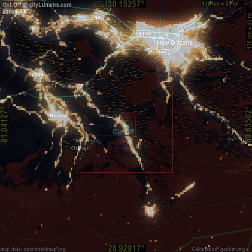
Analysis of Cut Off night lights 2016
Square area 10x10 km:
 2.08%
2.08%90-99
1.7%80-89
8.14%70-79
7.77%60-69
6.06%50-59
1.89%40-49
4.36%30-39
2.27%20-29
4.17%10-19
43.18%0-9
18.37%Square area 50x50 km:
0.37%90-99
0.32%80-89
1.76%70-79
1.87%60-69
1.49%50-59
0.72%40-49
0.9%30-39
1.4%20-29
1.53%10-19
10.42%0-9
79.23%Clear (daylight) street map image can be seen on geolist.org.
Map coordinates:
30° 9' 9.3" North, 91° 2' 28.6" West
29° 32' 33.8" North, 90° 20' 17.3" West
28° 55' 45" North, 89° 38' 6.1" West
Some cities around Cut Off sort by population:
• Houma
37.4 km =23.2 mi,  279°
279°
• Bayou Cane
41 km =25.5 mi, 282°
• Estelle
40.4 km =25.1 mi,  33°
33°
• Luling
43.4 km =27 mi,  356°
356°
• Woodmere
43 km =26.7 mi,  35°
35°
• Raceland
32.5 km =20.2 mi,  309°
309°
• Galliano
11.8 km =7.3 mi,  161°
161°
• Larose
5.4 km =3.4 mi, 308°
4321399 (p: 5,976)
Sources (retrieved 2019-11-25):
» Earth at Night: Flat Maps 2012, 2016