Anderson night lights from space
Night Light of Anderson (South Carolina) from space (United States) Src. Average luminocity for 10x10km area is 76.7028% and for 50x50km: 21.9015%.
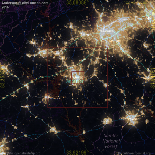
Analysis of Anderson night lights 2016
Square area 10x10 km:
 16.08%
90-99
15.38%80-89
12.76%70-79
19.06%60-69
18.18%50-59
7.17%40-49
8.04%30-39
2.8%20-29
0.52%10-19
0%0-9
0%Square area 50x50 km:
1.42%90-99
1.51%80-89
3.3%70-79
3.26%60-69
3.9%50-59
4%40-49
4.28%30-39
5.8%20-29
8.3%10-19
14.58%0-9
49.65%Clear (daylight) street map image can be seen on geolist.org.
Map coordinates:
35° 4' 51.1" North, 83° 21' 11.7" West
34° 30' 12.4" North, 82° 39' 0.5" West
33° 55' 19.2" North, 81° 56' 49.2" West
Some cities around Anderson sort by population:
• Easley
36.6 km =22.7 mi,  6°
6°
• Clemson
26.3 km =16.3 mi,  319°
319°
• Seneca
34.4 km =21.4 mi,  306°
306°
• Powdersville
35.1 km =21.8 mi,  24°
24°
• Centerville
5.9 km =3.7 mi,  302°
302°
• Homeland Park
4.1 km =2.5 mi,  207°
207°
• Central
27.3 km =17 mi,  333°
333°
• Piedmont
27.9 km =17.3 mi,  37°
37°
4569298 (p: 27,335)
Sources (retrieved 2019-11-25):
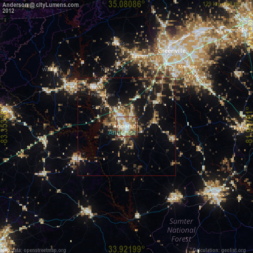
» Earth at Night: Flat Maps 2012, 2016