Sovetskiy night lights from space
Night Light of Sovetskiy (Crimea) from space (Ukraine) Src. Average luminocity for 10x10km area is 0.6413% and for 50x50km: 0.0624%.
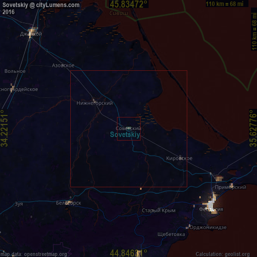
Analysis of Sovetskiy night lights 2016
Square area 10x10 km:
 0%
0%90-99
0%80-89
0%70-79
0%60-69
0%50-59
0%40-49
0.32%30-39
0.95%20-29
0.63%10-19
0%0-9
98.1%Square area 50x50 km:
0%90-99
0%80-89
0%70-79
0%60-69
0%50-59
0%40-49
0.01%30-39
0.07%20-29
0.07%10-19
0.09%0-9
99.76%Clear (daylight) street map image can be seen on geolist.org.
Map coordinates:
45° 50' 5" North, 34° 13' 17.4" East
45° 20' 33.6" North, 34° 55' 28.7" East
44° 50' 46.7" North, 35° 37' 39.9" East
Some cities around Sovetskiy sort by population:
• Feodosiya
49.8 km =30.9 mi,  133°
133°
• Bilohirsk
40.8 km =25.4 mi,  218°
218°
• Primorskiy
50.4 km =31.3 mi,  120°
120°
• Krasnogvardeyskoye
51.8 km =32.2 mi,  290°
290°
• Stary Krym
37.3 km =23.2 mi,  159°
159°
• Nizhnegorskiy
18.7 km =11.6 mi,  308°
308°
• Kirovskoye
24.9 km =15.5 mi, 120°
• Petrovka
52.6 km =32.7 mi, 289°
693062 (p: 10,410)
Sources (retrieved 2019-11-25):
» Earth at Night: Flat Maps 2012, 2016