Klishkivtsi night lights from space
Night Light of Klishkivtsi (Chernivtsi Oblast') from space (Ukraine) Src. Average luminocity for 10x10km area is 0% and for 50x50km: 1.8044%.
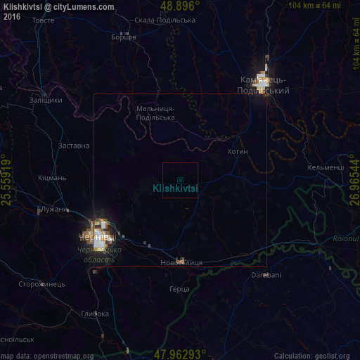
Analysis of Klishkivtsi night lights 2016
Square area 10x10 km:
 0%
0%90-99
0%80-89
0%70-79
0%60-69
0%50-59
0%40-49
0%30-39
0%20-29
0%10-19
0%0-9
100%Square area 50x50 km:
0.27%90-99
0.47%80-89
0.14%70-79
0.16%60-69
0.17%50-59
0.25%40-49
0.18%30-39
0.15%20-29
0.52%10-19
1.52%0-9
96.17%Clear (daylight) street map image can be seen on geolist.org.
Map coordinates:
48° 53' 45.6" North, 25° 33' 33.1" East
48° 25' 53.8" North, 26° 15' 44.3" East
47° 57' 46.5" North, 26° 57' 55.6" East
Some cities around Klishkivtsi sort by population:
• Chernivtsi
28.4 km =17.6 mi,  236°
236°
• Darabani, RO
36.4 km =22.6 mi,  139°
139°
• Khotyn
18.8 km =11.7 mi,  63°
63°
• Zastavna
32.5 km =20.2 mi,  288°
288°
• Novoselytsya
23.6 km =14.7 mi,  179°
179°
• Hudeşti, RO
35.9 km =22.3 mi,  150°
150°
• Suharău, RO
35.1 km =21.8 mi,  160°
160°
• Marshintsy
23.9 km =14.9 mi,  174°
174°
705626 (p: 6,272)
Sources (retrieved 2019-11-25):
» Earth at Night: Flat Maps 2012, 2016