Ünye night lights from space
Night Light of Ünye (Ordu) from space (Turkey) Src. Average luminocity for 10x10km area is 30.6088% and for 50x50km: 6.3576%.
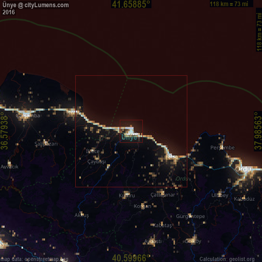
Analysis of Ünye night lights 2016
Square area 10x10 km:
 5.19%
5.19%90-99
6.82%80-89
2.6%70-79
1.3%60-69
5.03%50-59
1.62%40-49
4.38%30-39
3.73%20-29
2.11%10-19
49.51%0-9
17.69%Square area 50x50 km:
0.4%90-99
0.97%80-89
0.8%70-79
0.54%60-69
0.66%50-59
0.74%40-49
0.8%30-39
1.27%20-29
1.23%10-19
7.11%0-9
85.48%Clear (daylight) street map image can be seen on geolist.org.
Map coordinates:
41° 39' 31.9" North, 36° 34' 45.8" East
41° 7' 53" North, 37° 16' 57" East
40° 35' 58.8" North, 37° 59' 8.3" East
Some cities around Ünye sort by population:
• Fatsa
21.7 km =13.5 mi,  122°
122°
• Kumru
28.6 km =17.8 mi,  183°
183°
• Terme
27.2 km =16.9 mi,  288°
288°
• Korgan
34.5 km =21.4 mi,  171°
171°
• Perşembe
41.6 km =25.8 mi,  100°
100°
• İkizce
18.8 km =11.7 mi,  244°
244°
• Çamaş
32.8 km =20.4 mi,  141°
141°
• Akkuş
43.8 km =27.2 mi,  210°
210°
738349 (p: 77,585)
Sources (retrieved 2019-11-25):
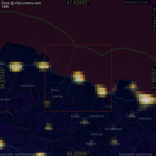
» NASA, Earths city lights 1995
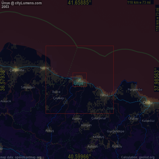
» NASA city lights 2003
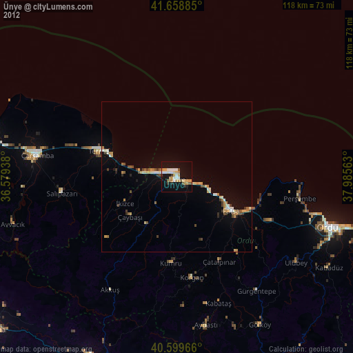
» Earth at Night: Flat Maps 2012, 2016