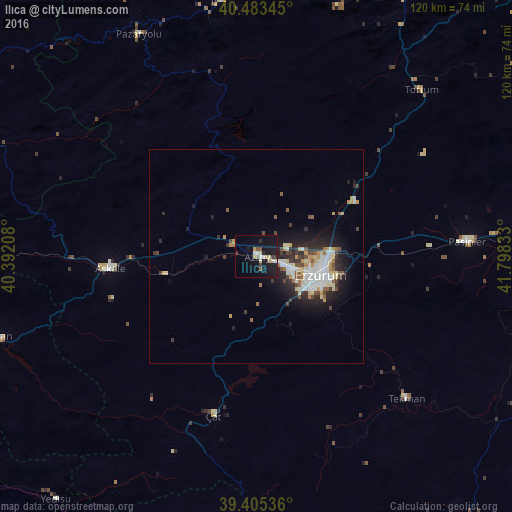
Ilıca night lights from space
Night Light of Ilıca (Erzurum) from space (Turkey) Src. Average luminocity for 10x10km area is 16.267% and for 50x50km: 6.665%.
Analysis of Ilıca night lights 2016
Square area 10x10 km:
 1.7%
1.7%90-99
1.87%80-89
3.74%70-79
1.02%60-69
1.19%50-59
1.36%40-49
0.68%30-39
1.36%20-29
2.89%10-19
22.79%0-9
61.39%Square area 50x50 km:
1.18%90-99
1.25%80-89
0.95%70-79
0.73%60-69
0.43%50-59
0.72%40-49
0.79%30-39
0.83%20-29
1.98%10-19
4.43%0-9
86.71%Clear (daylight) street map image can be seen on geolist.org.
Map coordinates:
40° 29' 0.4" North, 40° 23' 31.5" East
39° 56' 47.5" North, 41° 5' 42.7" East
39° 24' 19.3" North, 41° 47' 54" East
Some cities around Ilıca sort by population:
• Erzurum
16.1 km =10 mi,  105°
105°
• Pasinler
49.1 km =30.5 mi,  85°
85°
• Aşkale
34.2 km =21.3 mi,  265°
265°
• İspir
59.9 km =37.2 mi,  351°
351°
• Tercan
64.1 km =39.8 mi,  252°
252°
• Tortum
53.7 km =33.4 mi,  44°
44°
• Tekman
48.8 km =30.3 mi,  134°
134°
• Pazaryolu
58.7 km =36.5 mi,  331°
331°
311533 (p: 12,922)
Sources (retrieved 2019-11-25):
» Earth at Night: Flat Maps 2012, 2016