Suai night lights from space
Night Light of Suai (Cova Lima) from space (Timor Leste) Src. Average luminocity for 10x10km area is 3.9784% and for 50x50km: 0.3496%.
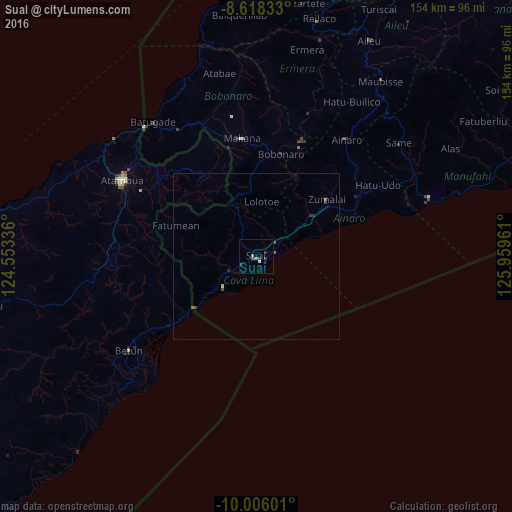
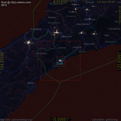
Analysis of Suai night lights 2016
Square area 10x10 km:
 0%
0%90-99
0.87%80-89
0%70-79
0%60-69
1.08%50-59
0.65%40-49
0.65%30-39
2.81%20-29
0.87%10-19
0.87%0-9
92.21%Square area 50x50 km:
0%90-99
0.03%80-89
0.03%70-79
0%60-69
0.05%50-59
0.14%40-49
0.08%30-39
0.16%20-29
0.14%10-19
0.04%0-9
99.31%Clear (daylight) street map image can be seen on geolist.org.
Map coordinates:
8° 37' 6" South, 124° 33' 12.1" East
9° 18' 46.3" South, 125° 15' 23.3" East
10° 0' 21.6" South, 125° 57' 34.6" East
Some cities around Suai sort by population:
• Atambua, ID
46.1 km =28.6 mi,  299°
299°
• Maliana
35.9 km =22.3 mi,  353°
353°
• Likisá
81.2 km =50.5 mi,  6°
6°
• Aileu
73.4 km =45.6 mi,  27°
27°
• Maubara
78.1 km =48.5 mi,  355°
355°
• Ainaro
45.1 km =28 mi,  37°
37°
• Gleno
68.4 km =42.5 mi,  16°
16°
• Same
55.1 km =34.2 mi,  51°
51°
1626459 (p: 21,539)
Sources (retrieved 2019-11-25):
» Earth at Night: Flat Maps 2012, 2016