Maubara night lights from space
Night Light of Maubara (Liquiçá) from space (Timor Leste) Src. Average luminocity for 10x10km area is 0% and for 50x50km: 0.2226%.
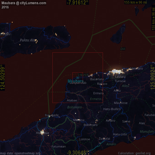
Analysis of Maubara night lights 2016
Square area 10x10 km:
 0%
0%90-99
0%80-89
0%70-79
0%60-69
0%50-59
0%40-49
0%30-39
0%20-29
0%10-19
0%0-9
100%Square area 50x50 km:
0%90-99
0%80-89
0%70-79
0%60-69
0.03%50-59
0.08%40-49
0.15%30-39
0.07%20-29
0.1%10-19
0.07%0-9
99.49%Clear (daylight) street map image can be seen on geolist.org.
Map coordinates:
7° 54' 58" South, 124° 30' 10.8" East
8° 36' 43" South, 125° 12' 22" East
9° 18' 23.3" South, 125° 54' 33.3" East
Some cities around Maubara sort by population:
• Dili
40.8 km =25.4 mi,  81°
81°
• Atambua, ID
64.9 km =40.3 mi,  212°
212°
• Maliana
42.2 km =26.2 mi,  177°
177°
• Likisá
15.2 km =9.4 mi, 79°
• Aileu
41.7 km =25.9 mi,  108°
108°
• Ainaro
53.8 km =33.4 mi,  141°
141°
• Gleno
28.2 km =17.5 mi,  116°
116°
• Same
65.3 km =40.6 mi,  131°
131°
1635826 (p: 16,300)
Sources (retrieved 2019-11-25):
» Earth at Night: Flat Maps 2012, 2016